The Hike:
- Elevation: 4,665 feet
- Distance: 9.6 miles RT
- NWFP required at Bivouac.
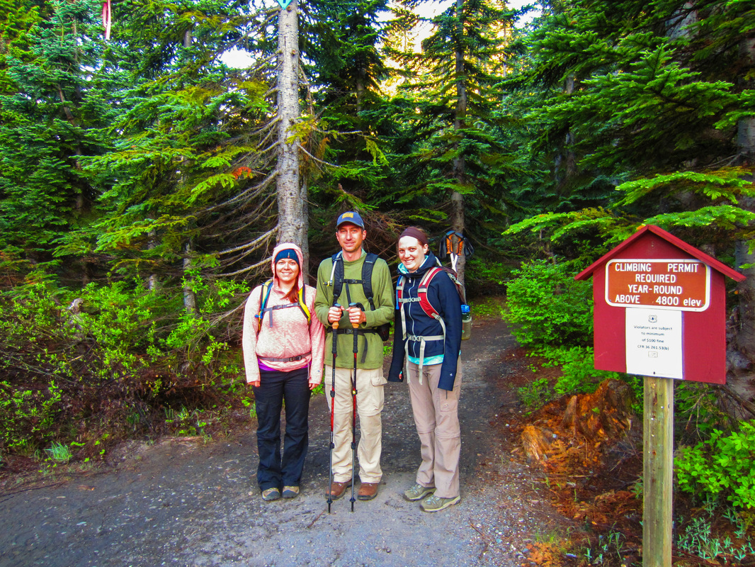
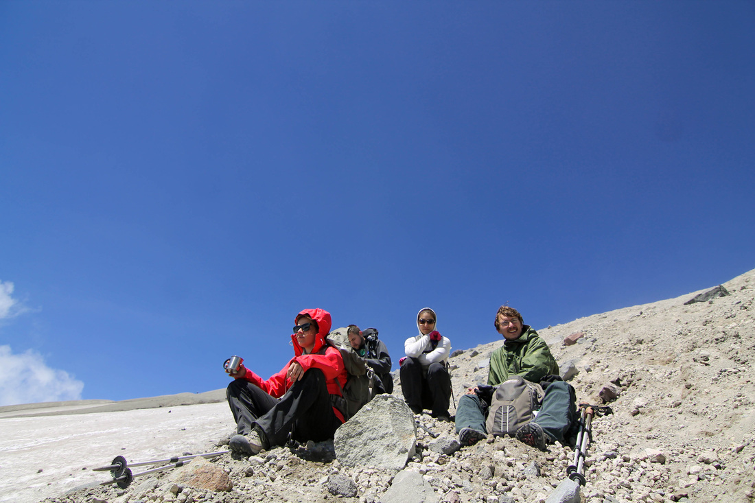
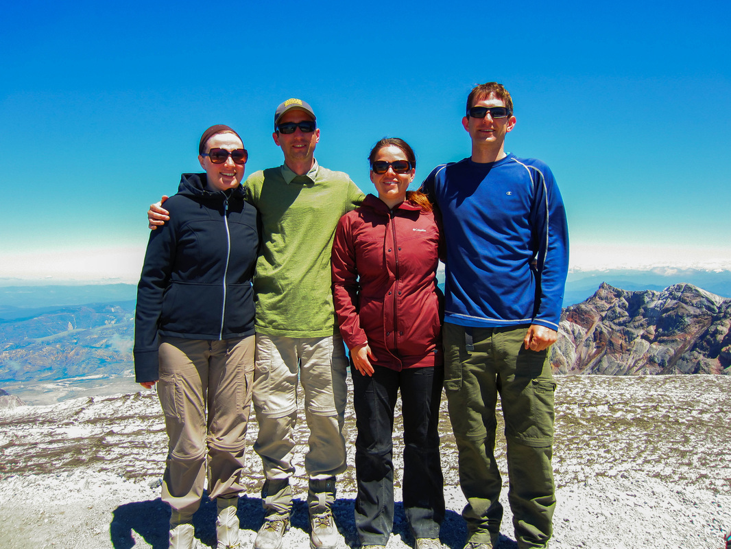
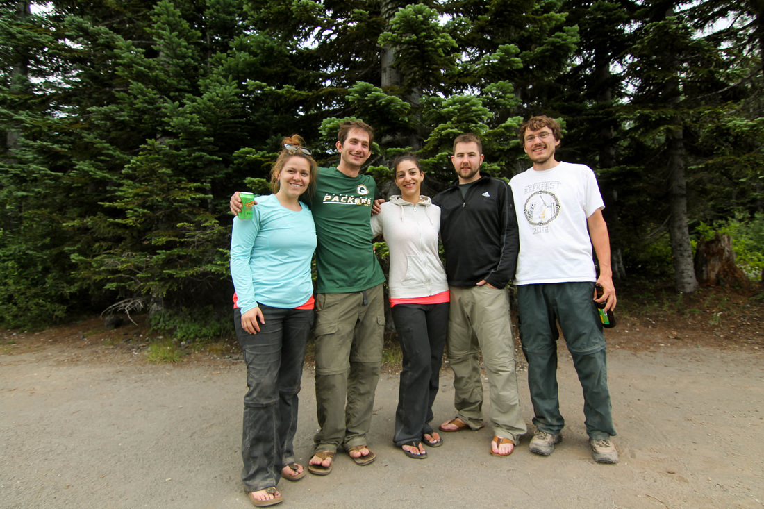
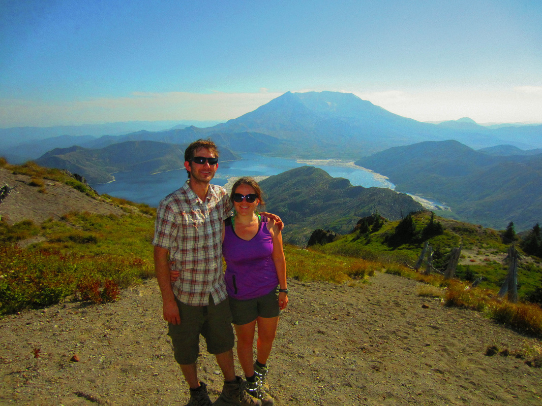
Mary, Jordan, Aaron and I drove to the climbers bivouac for Mt St Helens on Friday after work. It was a lovely, clear evening and a pleasant morning. The northwest had been dry for months now, and warmer than usual so we were expecting relatively good climbing conditions. The hike set out how we expected. 
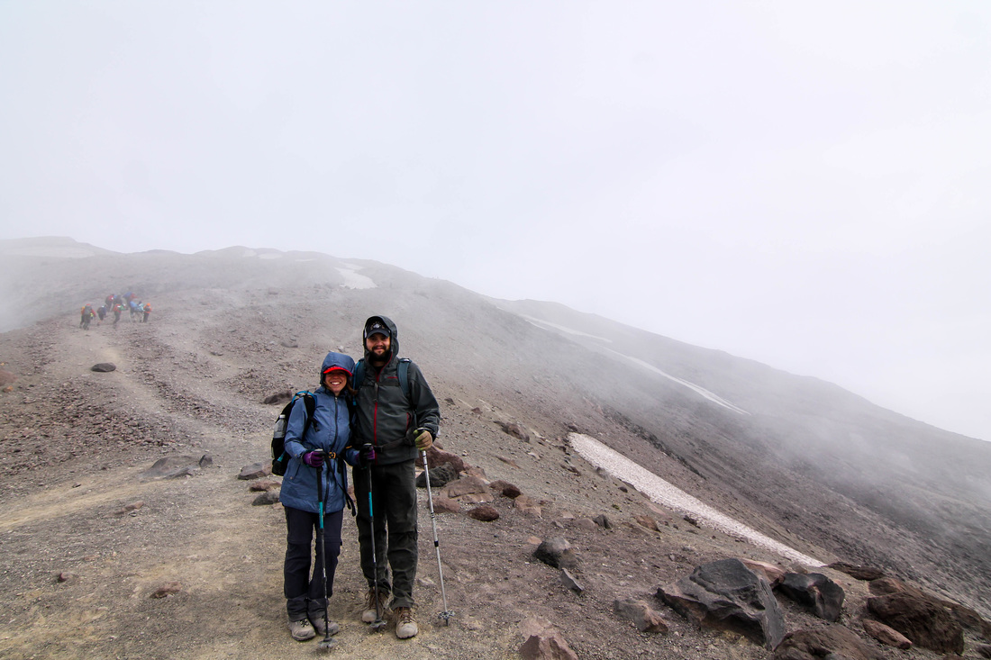
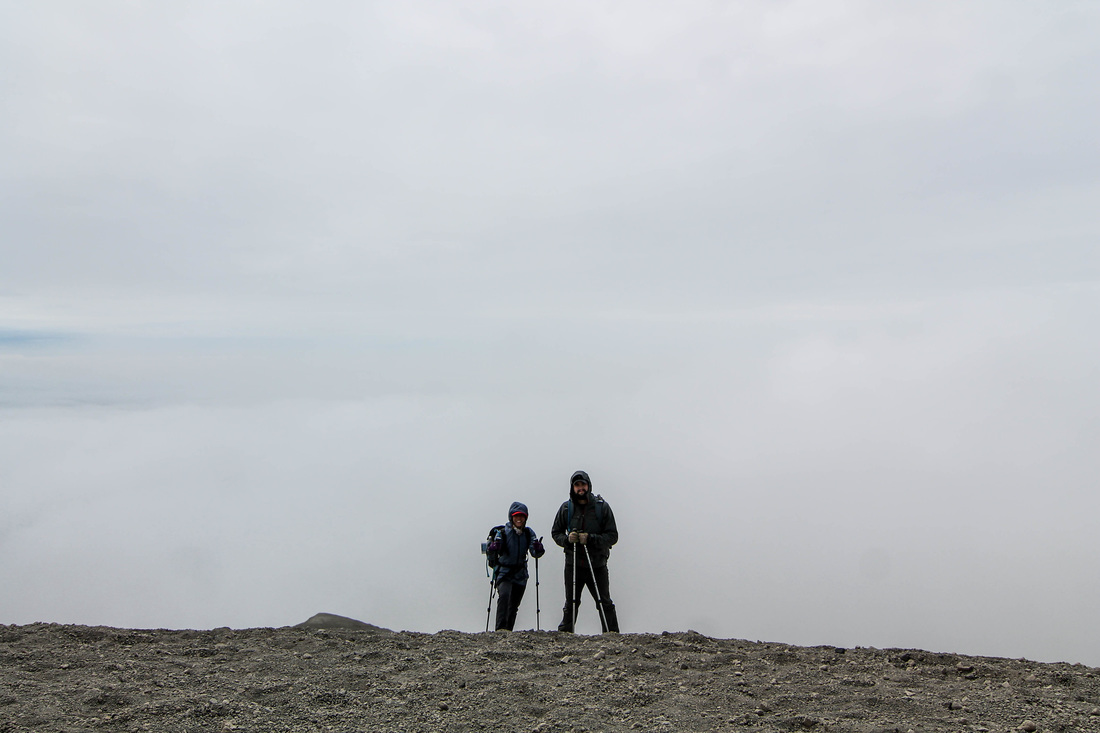
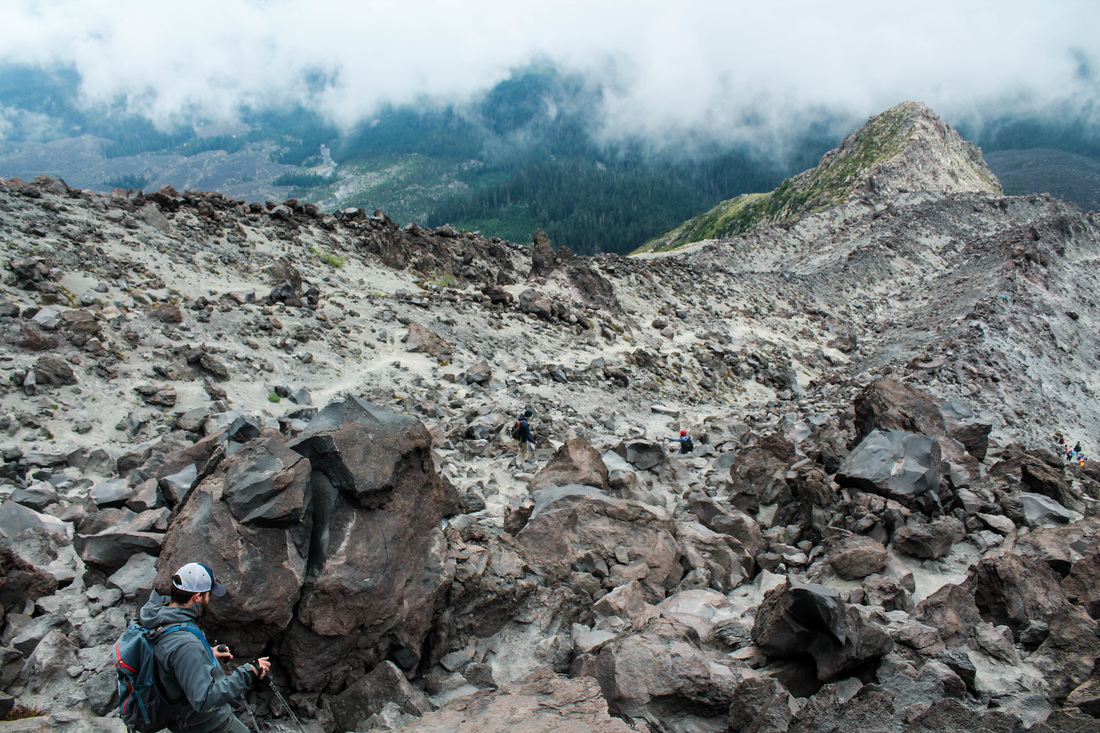
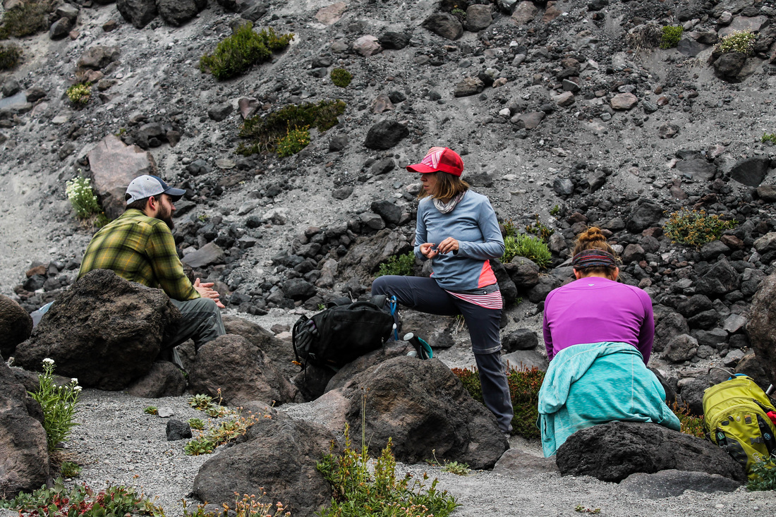
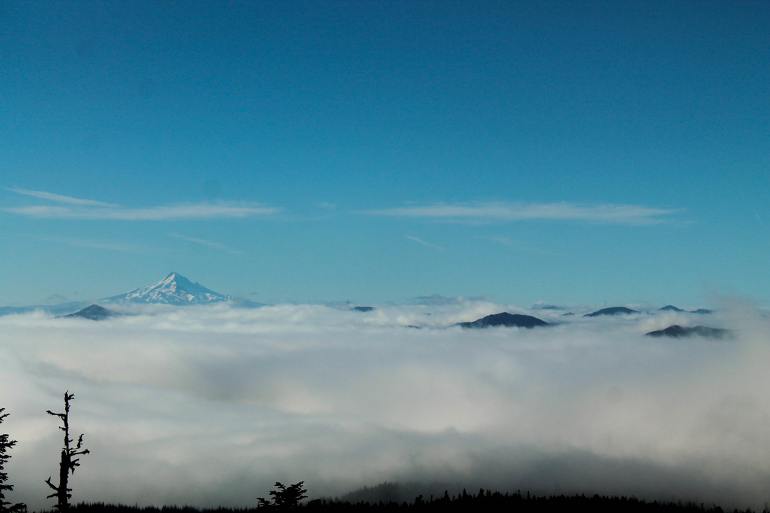
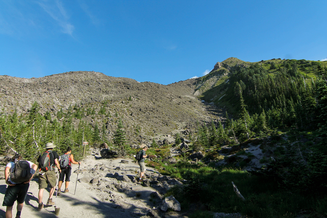
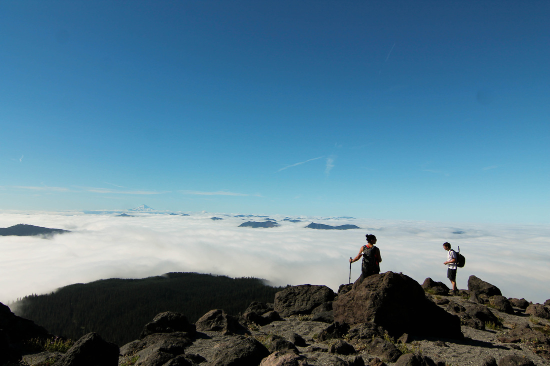
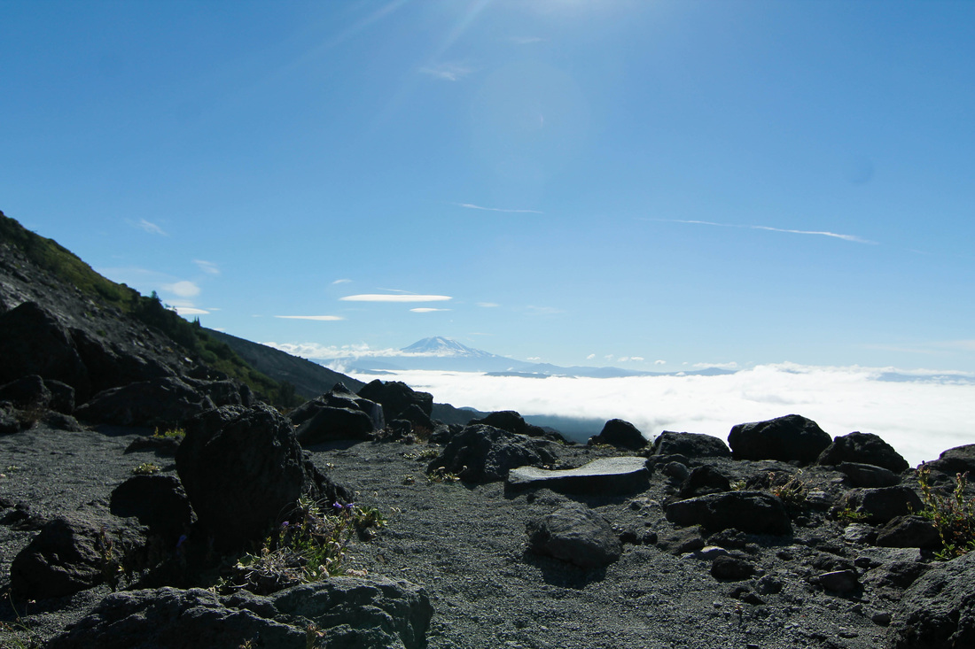
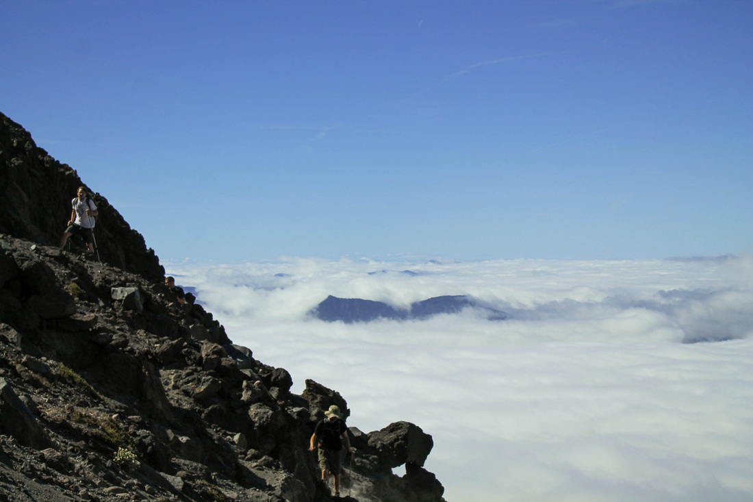
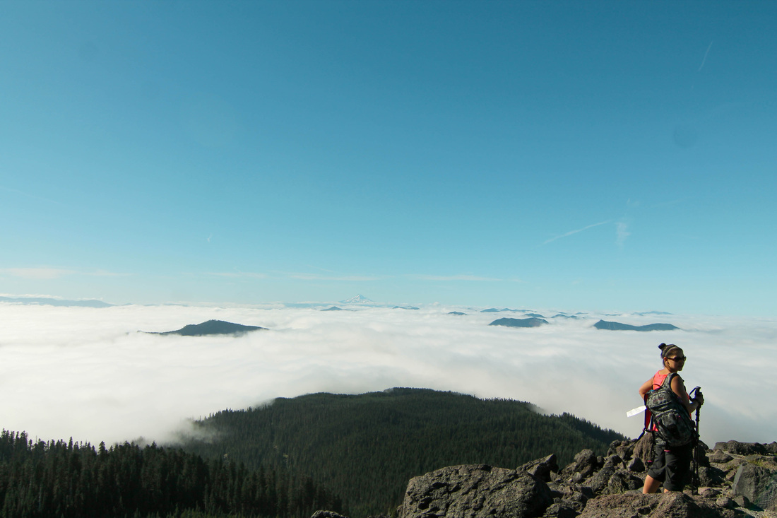
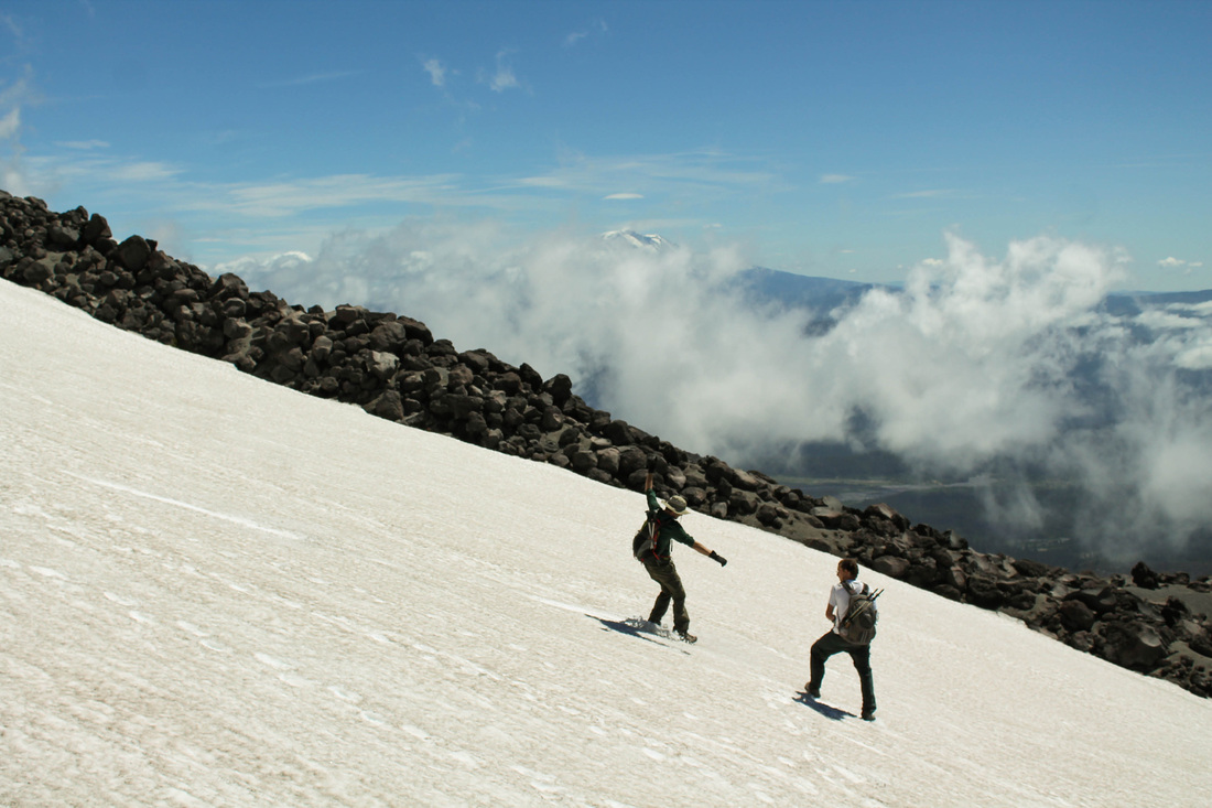
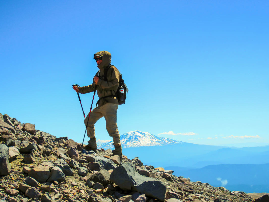
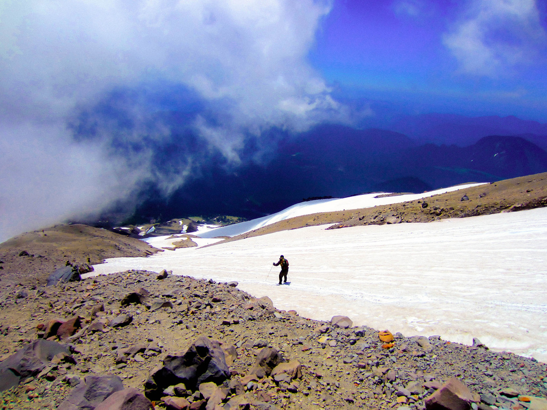
The clouds rolled in shortly after we began the ascent in the scree. And they never let up until we were on our way back down again. This was Aaron and my third time climbing this mountain, and it was by far the worst conditions. I was contemplating turning back, I'm certain Jordan wanted to as well, but Mary and Aaron continued on without hesitation, so I followed in line. Normally, there would be views of Mt Adams and Mt Hood that would be motivating you to continue the ascent. This day, all we saw was white. At times, the visibility was less than 50 feet. The winds increased the higher we got and were relentless. They would howl for minutes without a break. It was very draining physically and mentally. But we climbed on.
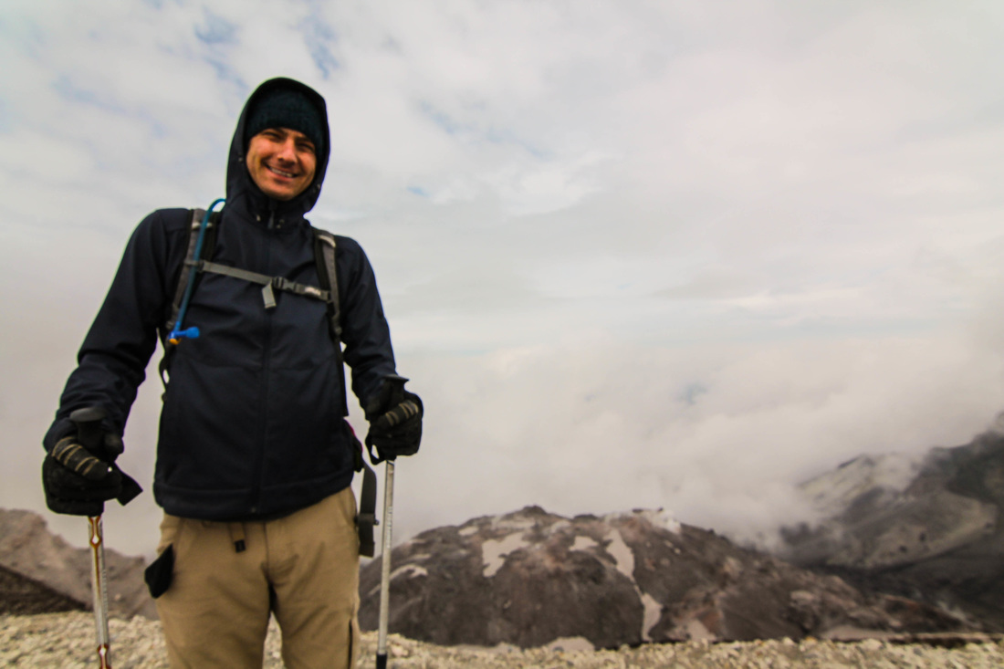
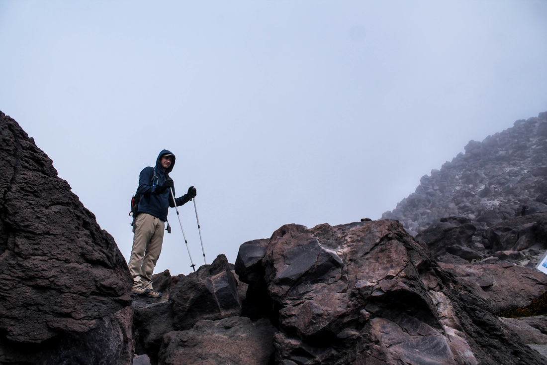
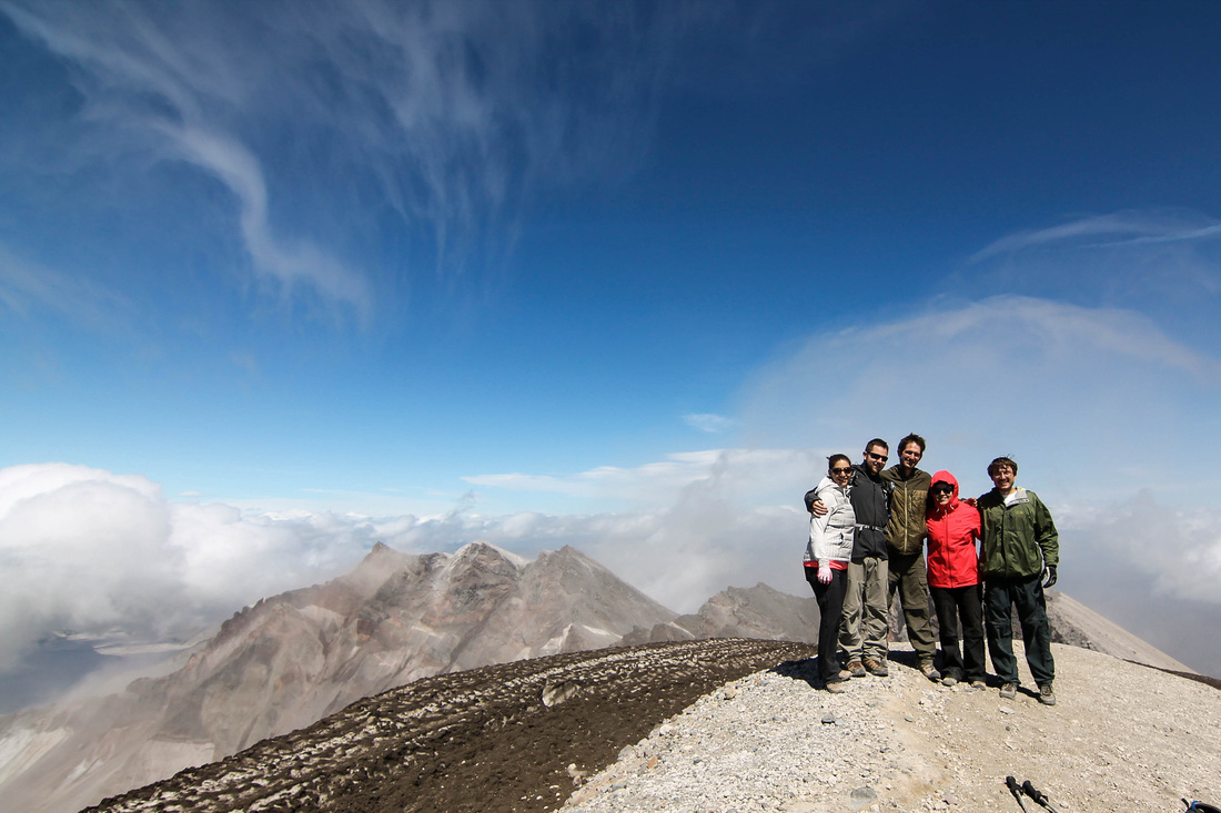
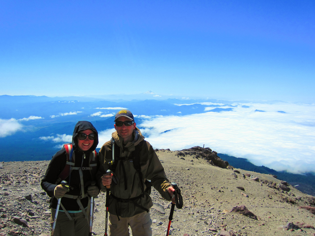
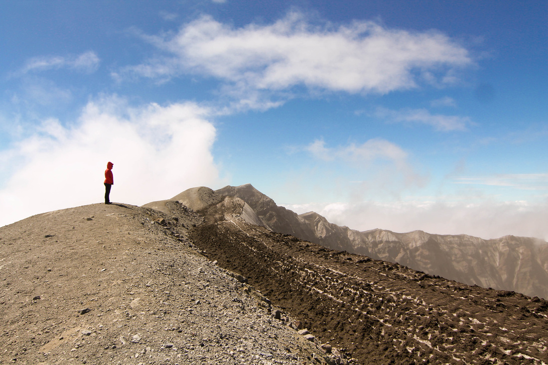
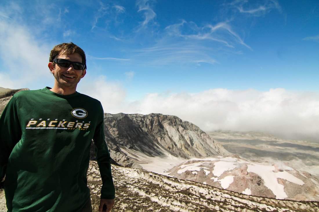
 
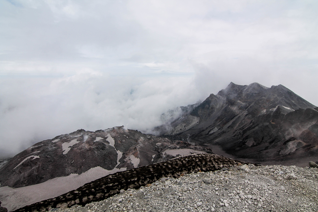
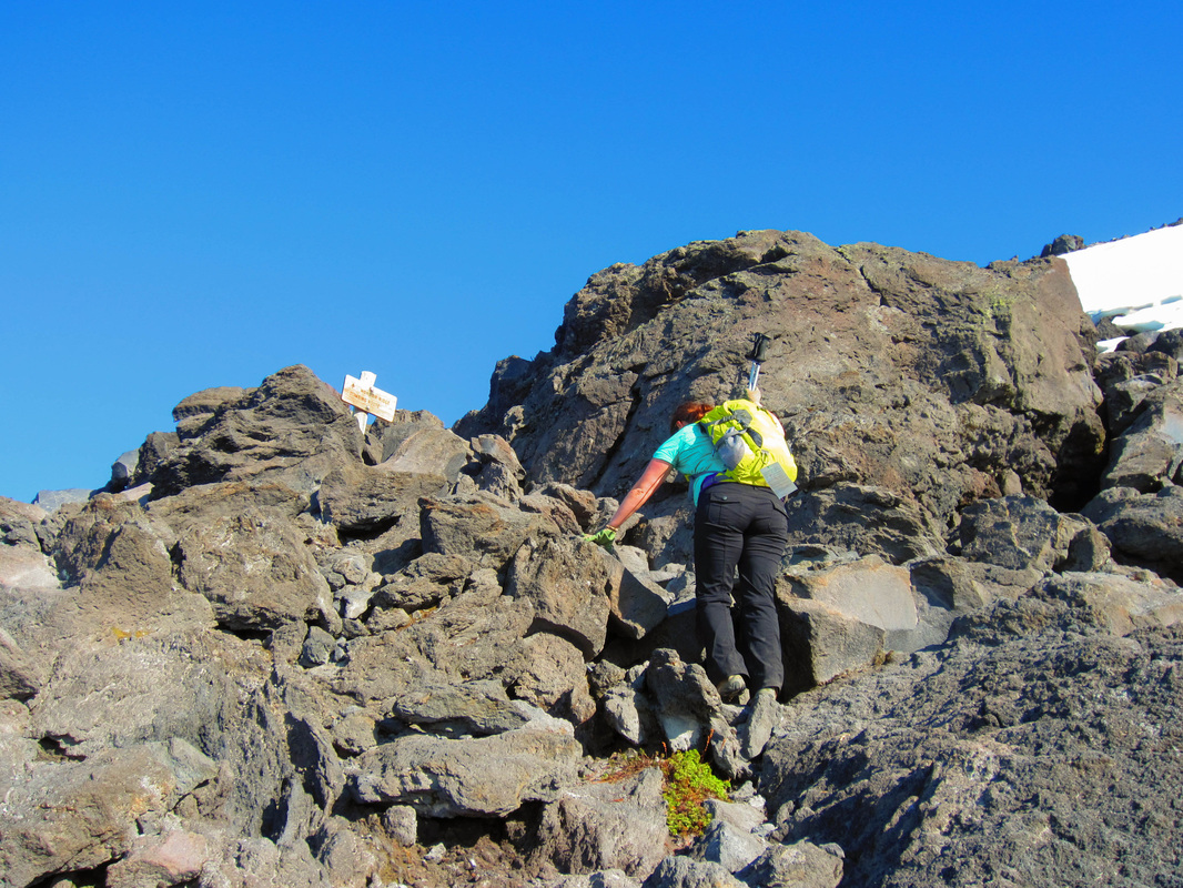
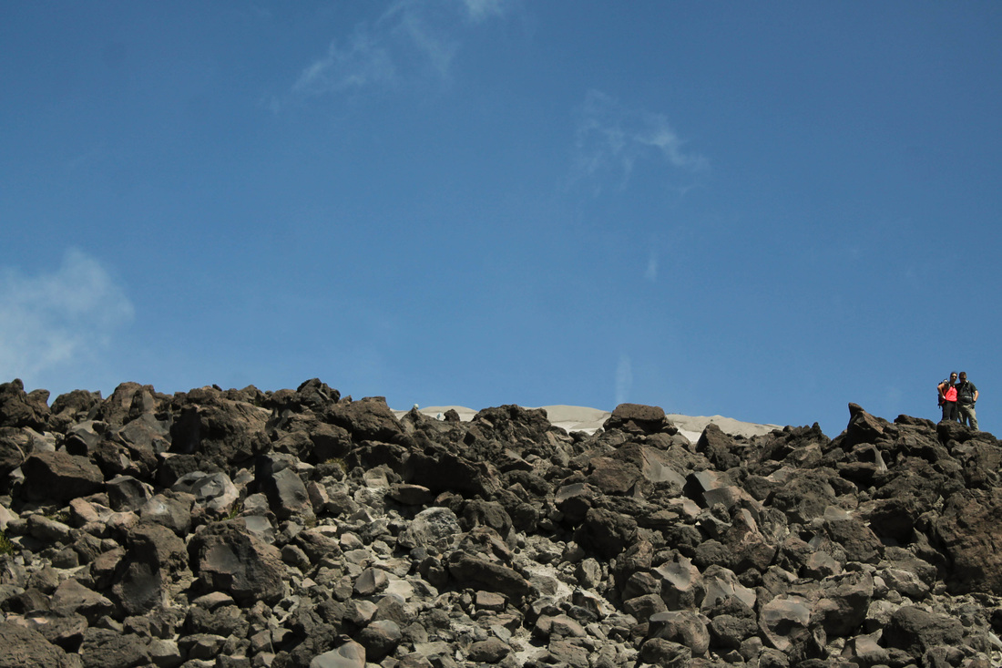
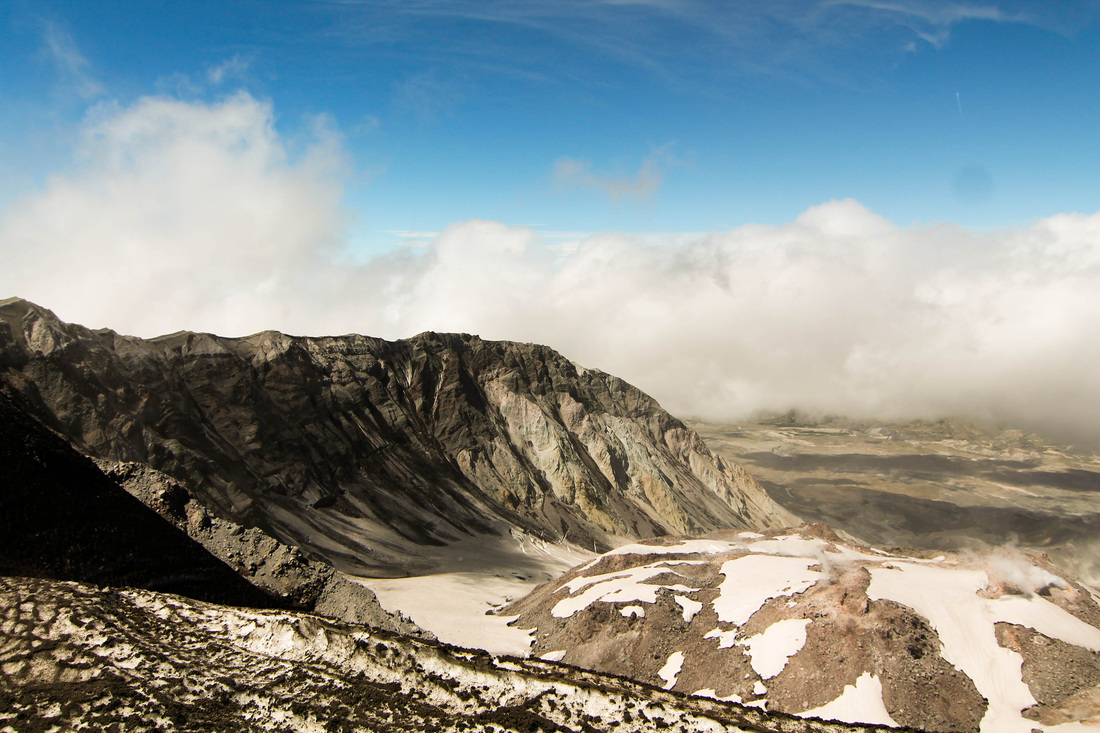
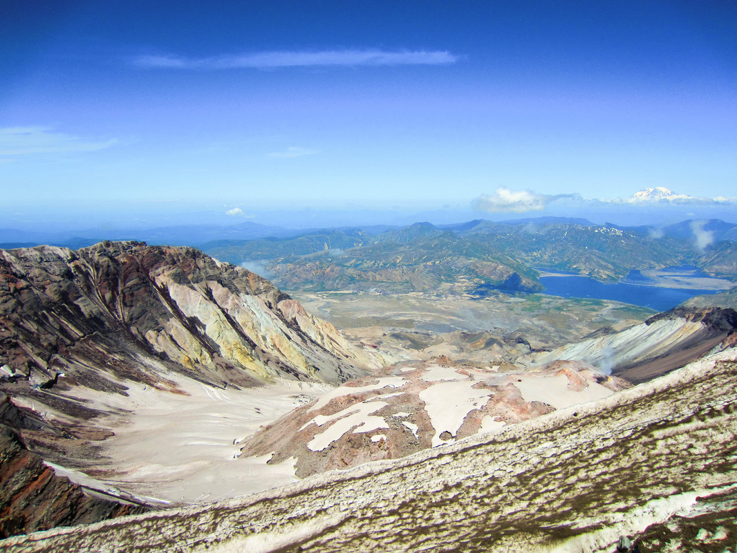
When we reached the top, the clouds broke enough to see the lava dome and the rim of the caldera. We hung out there 20-30 minutes maximum and then headed back down. 
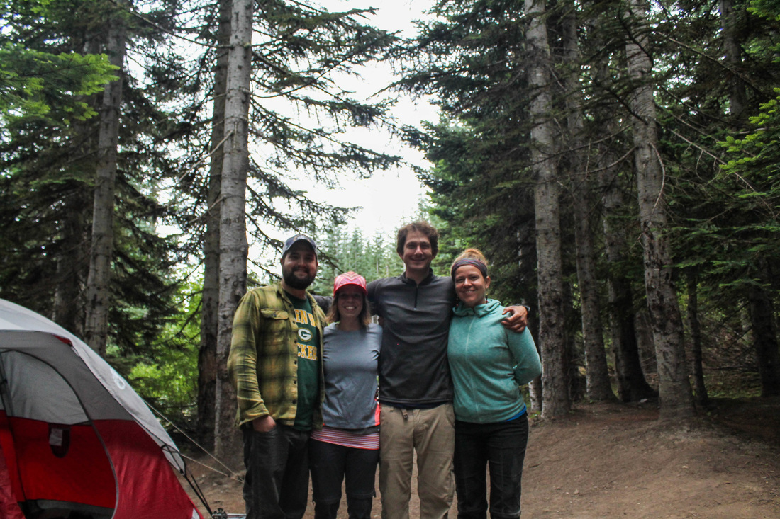
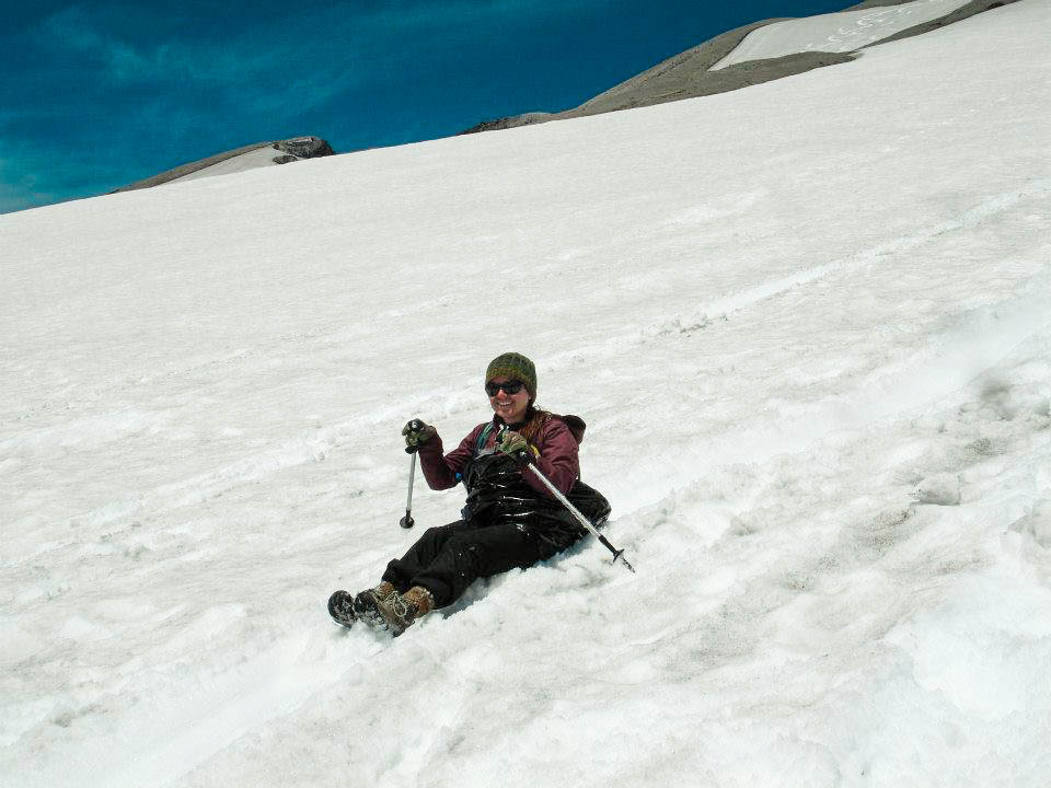
We got back to camp and decided to spend the night again since it's free and we wanted to enjoy each other's company around the fire again. Despite the poor hiking conditions, it was a great time and challenged us as hikers mentally and physically.
The Hike:
0 Comments
The first time we hiked Mt St Helens (MSH) was for Aaron's birthday last year (July 8th). We hiked it with Aaron's brother, Seth, and his lovely wife, Jennie. This year, we hiked with friends Maria, Jake and Nate. We arrived at the climbers bivouac (I love that word) around 7pm on Friday night after battling traffic. We got our fire going to so that we could cook dinner. It was a clear night and the stars proved to be shinning bright. Maria, Jake and I hit the hay relatively early. Aaron and Nate stayed up drinking beers, and I fell asleep listening to their alcohol influenced conversation about galaxies far away and "weird dark matter that is surrounding the universe and making it expand infinitely." We all got up around 5am on Saturday and quickly got to work cleaning up camp. Maria made us an amazing hot breakfast of potatoes and eggs with the works. We hit the trail at 7:11 and started our trek through the woods. From the trailhead, it's 2.25 miles to the start of the Monitor Ridge trail. Permits are required to hike above 4,800 feet. This is important: if you plan to hike MSH, you need to get your permit ($22) the day they go on sale. If you want to hike on a weekend in the summer, you need to get your permit within the first 10 minutes. They are limited to 100 hikers/day and they sell out fast. Last year, we were on the trailhead at 6am. I would recommend leaving at this time. It makes for better views at sunrise. And, if you're a slower hiker like me, you will have plenty of time to reach the summit and get back down in time to grab pizza at the Lone-Fir in Cougar. The first portion of the hike is a 2 mile (900 feet) stroll through woods. Upon leaving the forest, you'll immediately happen upon piles of boulders, and remember that you're hiking the most active volcano in the Cascade mountain range. You'll traverse a few switchbacks and then hit the Monitor Ridge Trail. After this, any vegetation will be sparse. Pumice and sharp boulders, however, will be plentiful. After hiking up an ash ridden ridge, you'll come across the boulder fields. At this point, ditch your poles, put on gloves with a grip and start climbing. Personally, I prefer this over walking up ash that slides under your feet. Views improve of both Mt Adams and Mt Hood during the entire ascent. You're quickly above the clouds so even if the mountains are unseen from Portland, you'll be lucky enough to keep the views. During the hike, you'll go through several wardrobe changes. Both times, I wore every layer and article of clothing that I brought with. Weather changes quick on mountains. When we hiked it in 2013, it was much sunnier, however, colder. This year, we felt the wrath of the wind gods. I think it took us longer to hike because the wind would come on so strong, we had to hunker down and brace ourselves until it passed. We were also slightly delayed as Nate was enamored with the inside of a glacier. After completing the boulder field, you lie your eyes on the only thing between you and the summit: a steeply graded 1,000 foot gain of sand-like ash. It's a good idea to find a boulder in the distance as a goal to take your next break. Before you know it, you'll be at the top! Take in the views at top and fuel up for the descent. A fun option is to glissade down the glacier. It is awesome. The best way is to bring up a large trash-bag to don as a diaper (just kick threw two holes out the bottom). You may have some bruises on your bottom (an actual bone bruise if you're Seth), but when are you going to get another chance to sled down a volcano? After your hike, head to the Lone-Fir in Cougar to sign out that you made it off the mountain. Since Portland is a bit of a drive back, it's wise to eat pizza here as you will be famished. It's not the best but it doesn't have to be when you're that hungry. The Hike:
Aaron and I drove to Beaver Bay Campground (on Yale Lake) after work on Friday. We arrived after dark and were quickly greeted by friendly campers helping us find our site. We got busy starting a fire and drinking a few beers. The neighbors behind us had foul mouths and seemed to think there was no one else staying at this campground (or they just didn't give a damn). They soon stumbled over to our sight in hopes to make drinking friends. Which we did not oblige. We were not surprised to learn they were from Tacoma.... they're always from Tacoma. We did our best to end the conversation and about 25 minutes later they left the way they came, drunkenly. We woke up early enough to walk over to Yale Lake and enjoy a somewhat peaceful morning. Then, we made our way to our primary destination of the weekend: Mount Margaret. There is no easy way to drive to this trailhead. We accessed it from the Norway Pass trailhead. It's a 3 hour drive from Portland, hence the midway camping spot for us. As for the hike: one source refers to it as, "a long hike with more beauty than the eye can absorb." And it really did live up to it's reputation. It begins by a steep climb for a mile. Not far in, you will have a view of Mt Adams that will keep for the remainder of the hike. Views of Mt Rainier improve as you work your way. We had an interesting encounter with an elk hunter who approached us in full camo. He requested that we follow him. We did so without hesitation, wondering if we were ignorantly following a lunatic with a full set of bow and arrow deeper into the back-country. He turned out to be a very sweaty, yet, friendly man that wanted to show us a mountain goat on a distant hill-side. He even let us use his awesome binoculars. We thanked him and continued on the trail. We encountered snow, which felt great at the time. Another cool aspect of this hike is that you are hiking through the blast zone of Mt St Helens. One part is referred to as "match-stick forest," because the trees were splintered as if they were match-sticks from the powerful lateral blast. MSH is awesome! Unfortunately, it was a hazy that day. I have read that views can be even better than what we saw. At the summit, we watched a heard of wild elk on a plateau in the distance. We went back the way we came and saw a family gathering what was left on the huckleberry bushes (if we had been there a few weeks earlier, there would have been a lot more). We stopped at the Lone Fir in Cougar and rewarded ourselves with pizza. Then, headed home. The Hike:
Three unique waterfalls make up this easy hike along the Lewis River. From the Lower River Falls trailhead, take advantage of a few spots for different views of the falls (I think the best of the 3). You are able to walk around on top of the falls with minimal danger. After exploring this falls, continue on the trail through the campground. There will be branching trails, just keep right along the river. The next falls will be Middle Lewis River Falls. When we came upon the middle falls, there was a trio of hippies swimming here. They told us that you could also snorkel there. It was a chillier summer day and we weren't prepared for a swim but I would like to try snorkeling here. As you continue to meander on the path, you will reach Upper Lewis River Falls. Return the way you came. The Hike:
|
I moved to the Pacific Northwest in August of 2012. I quickly identified myself as a hiker. I want to document my experiences so that I can refer to them for myself and others to provide the best hiking experience. I also hope to learn more about hiking from others comments and recommendations. Archives
April 2016
Categories
All
|