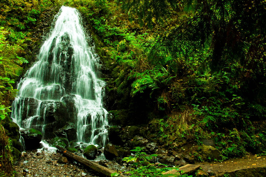
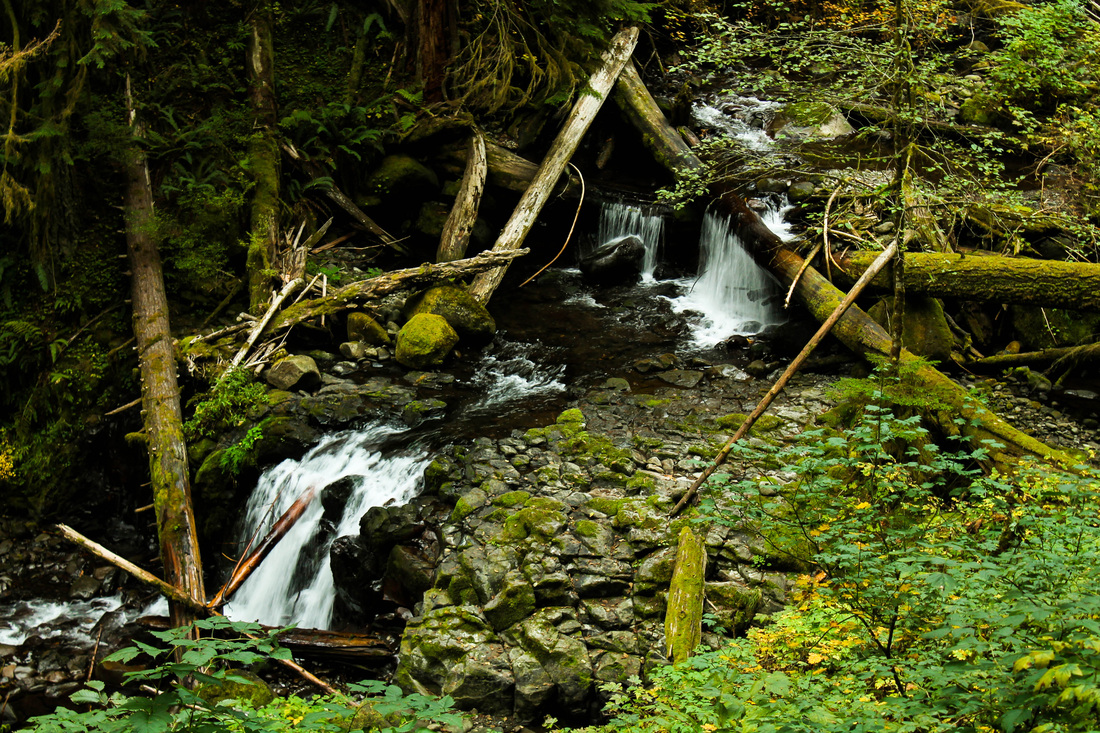
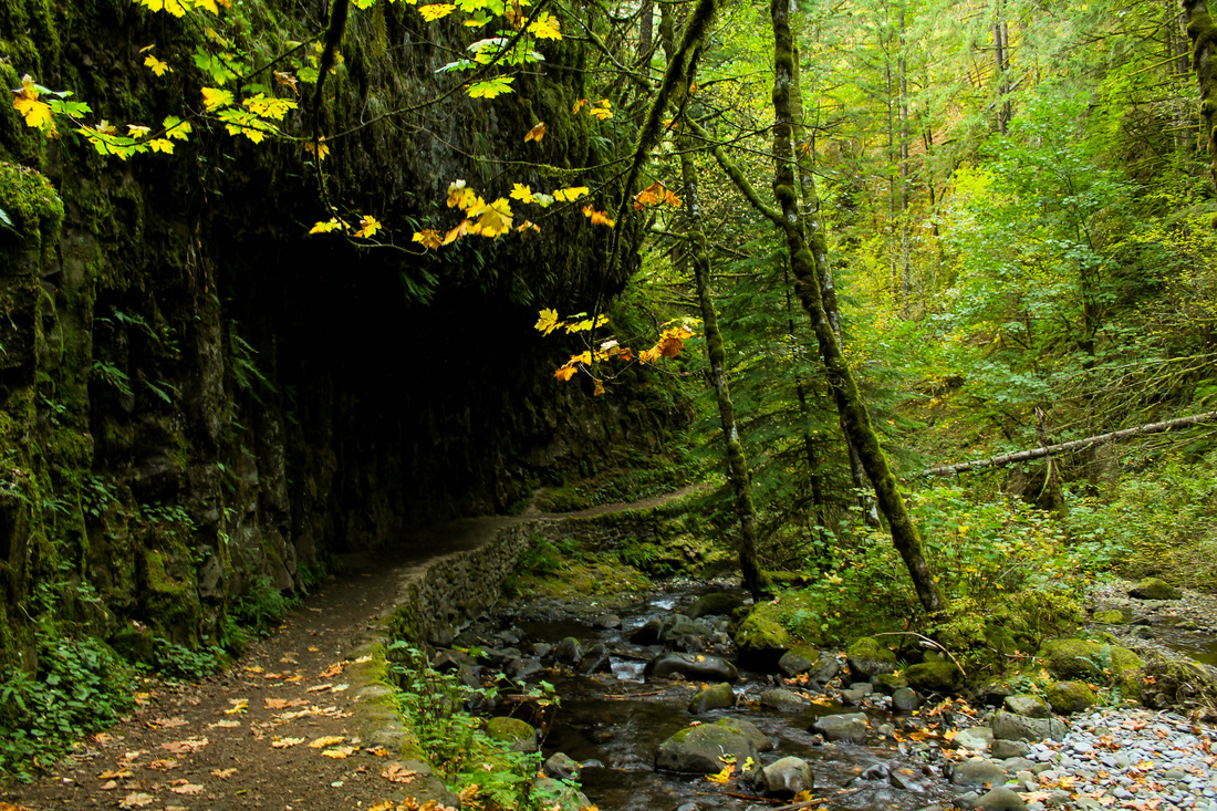
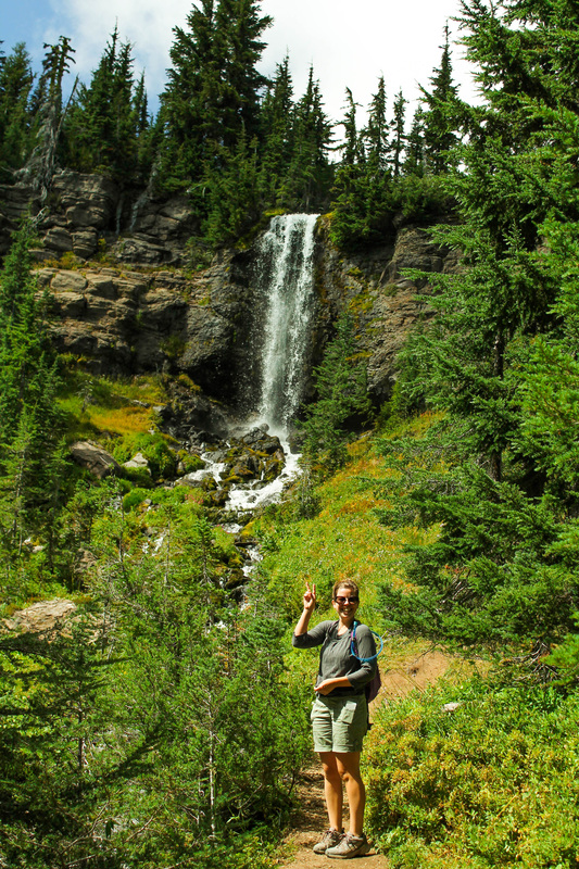
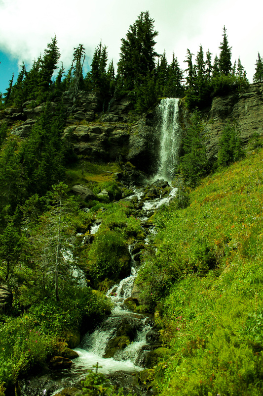
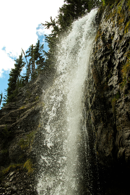
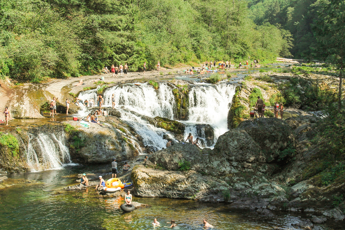
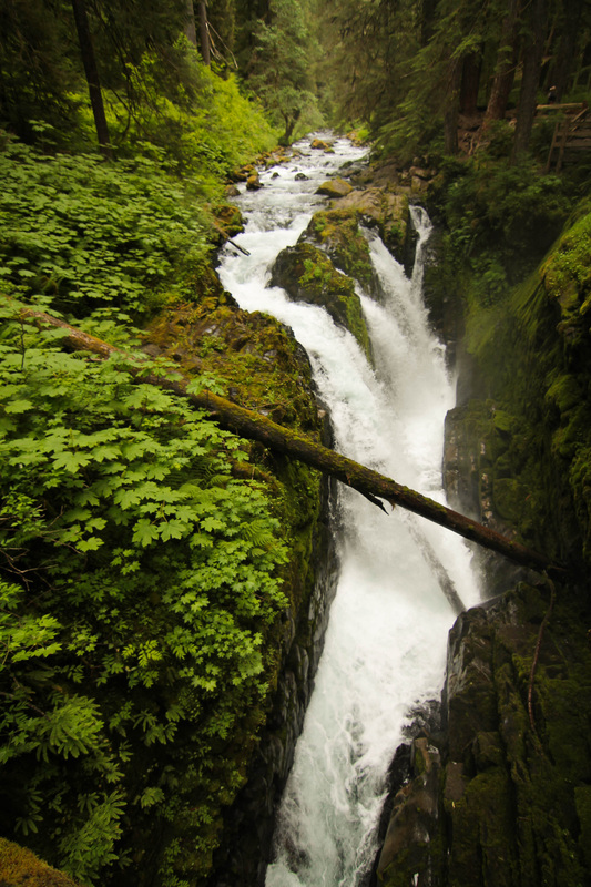
- Elevation: 1,600'
- Distance: 5 miles
- No pass required at trailhead
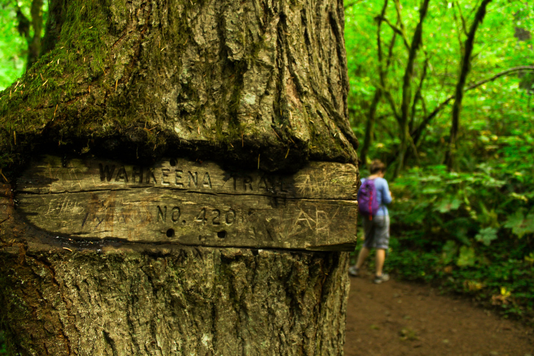
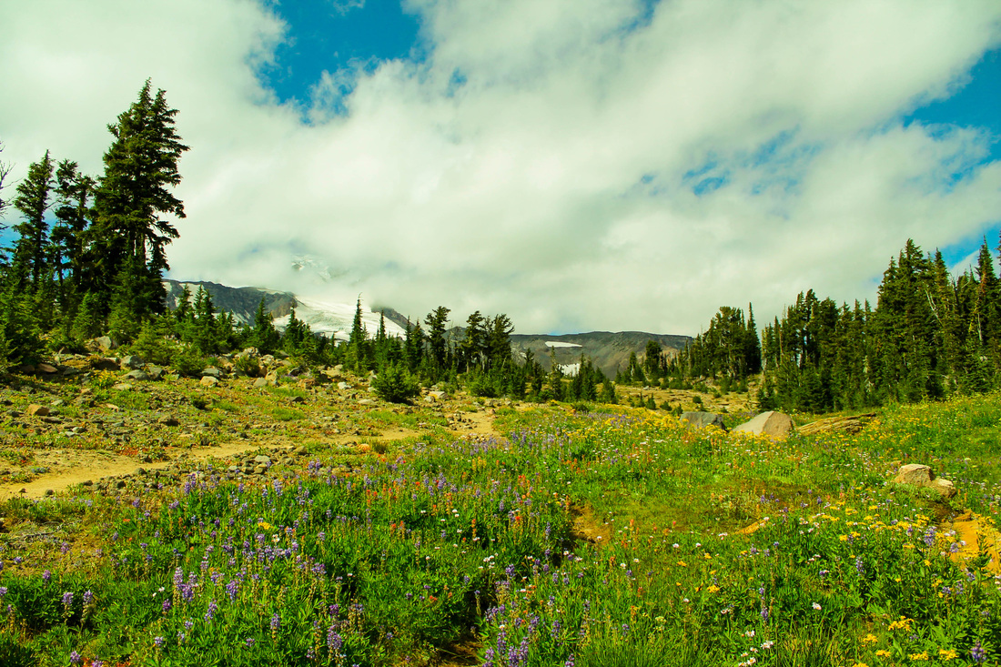
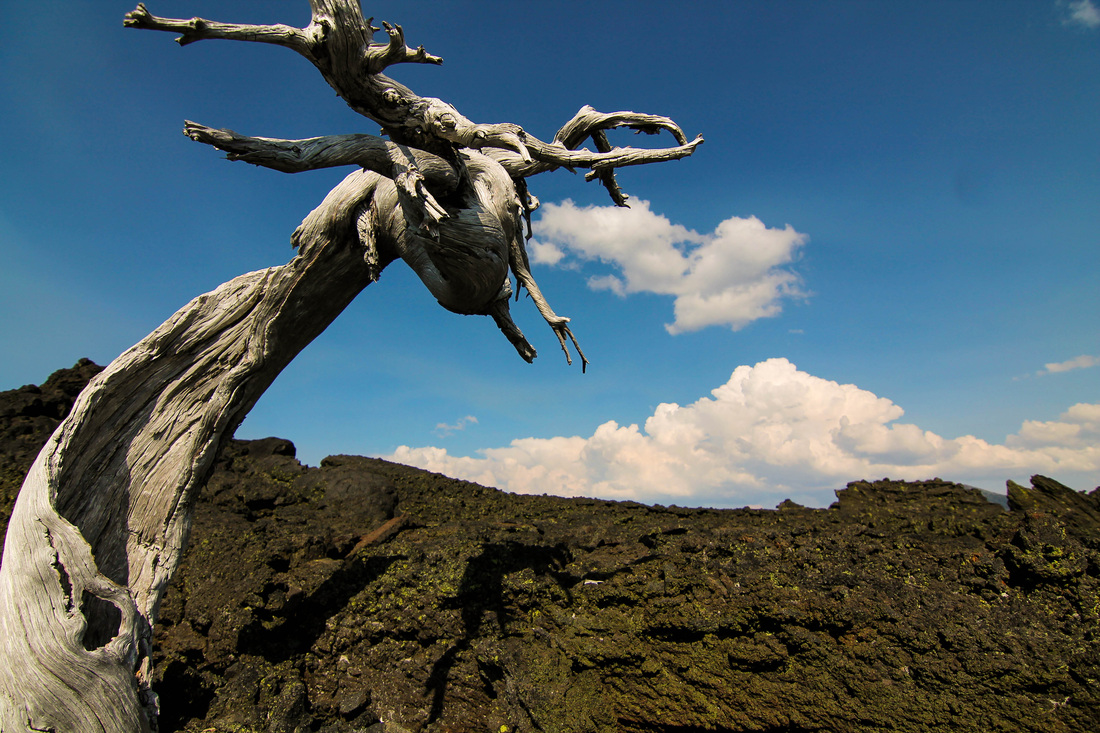
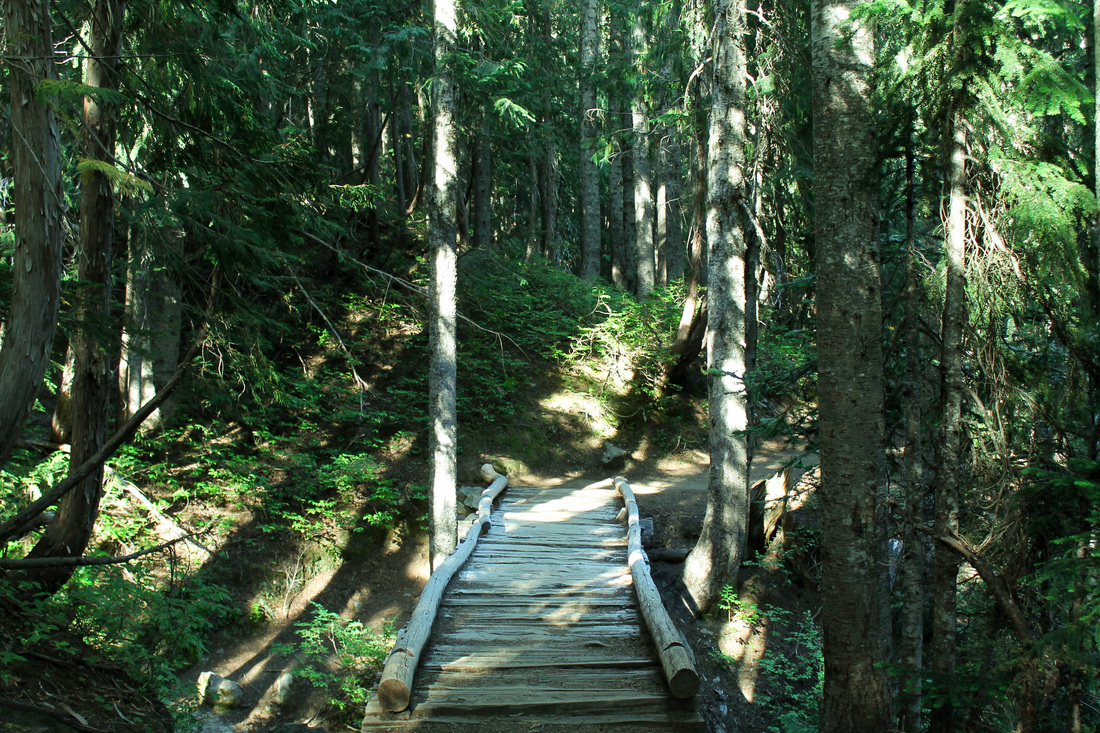
Friday was a beautiful day and the weekend forecast called for rain. Mary met me after work and we made the 30 minute drive to Multnomah Falls. We parked there and walked to the Wahkeena Falls trailhead. After a few quick switchbacks, the falls is reached in .2 miles. Continue up more switchbacks and you begin to trace the river that feeds Wahkeena falls. The trail climbs steadily with breaks where it flattens to give you a short break. The next falls you reach is Fairy Falls (pictured above).
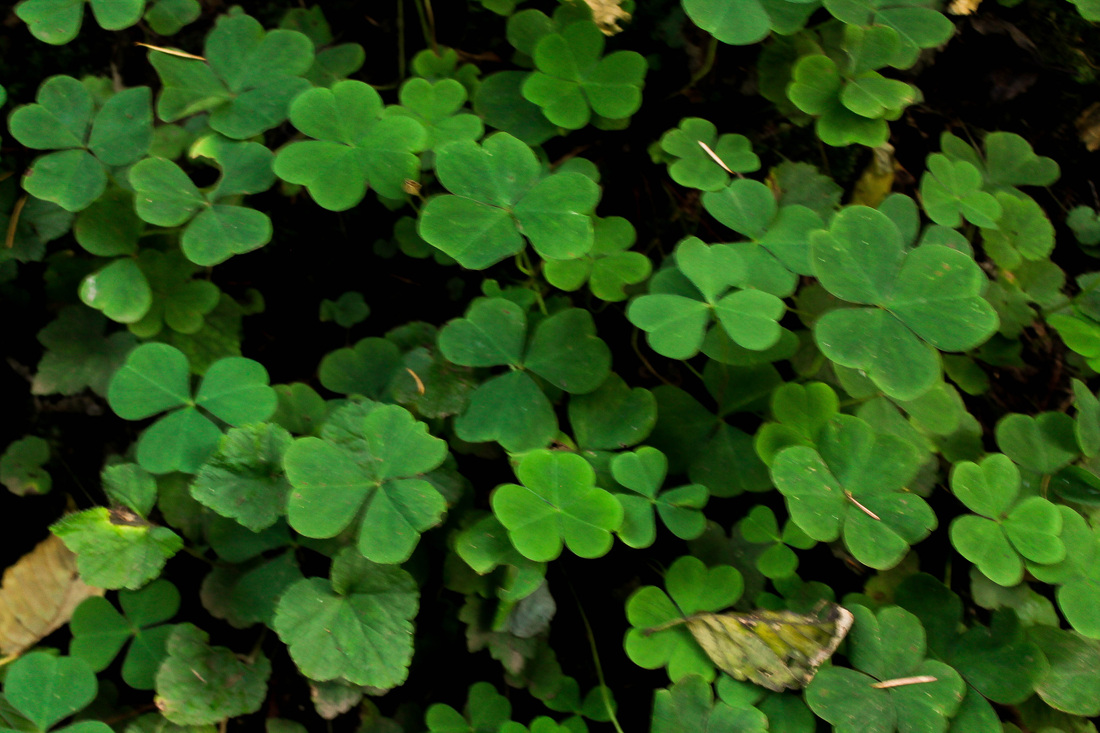
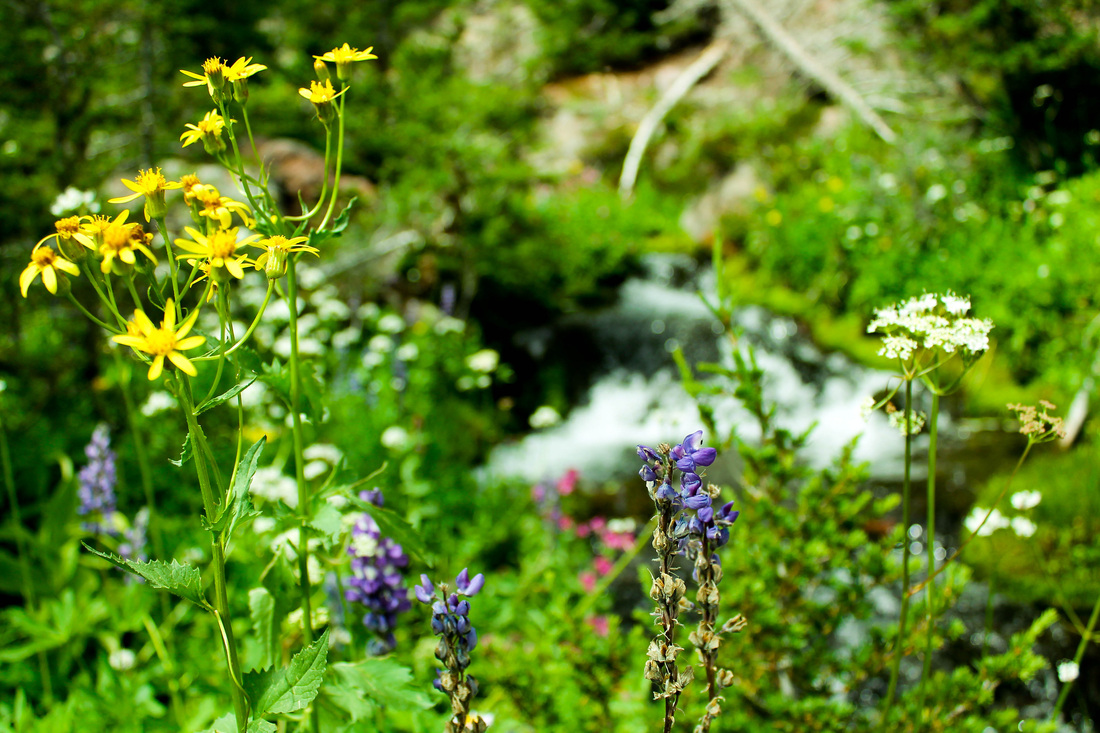
 
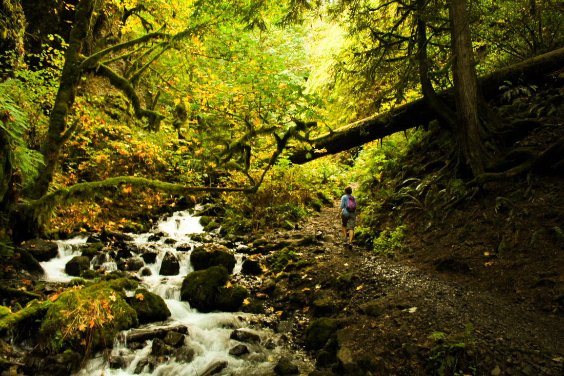
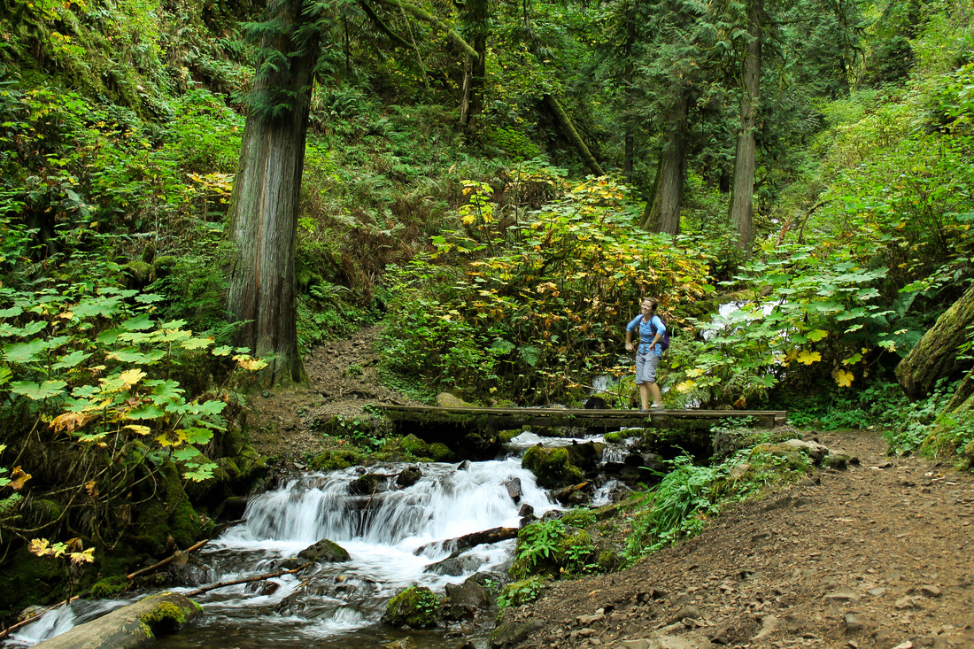
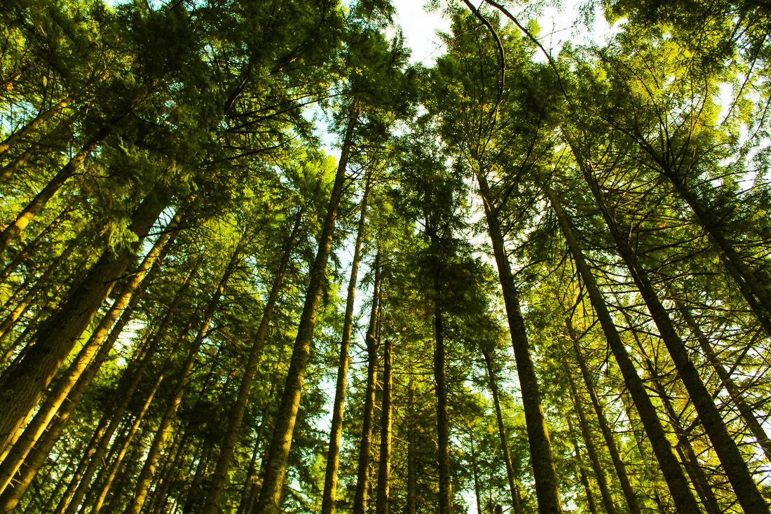
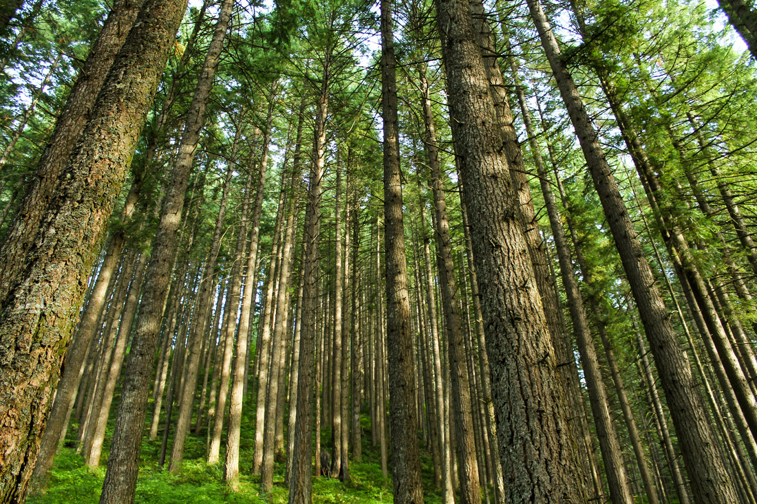
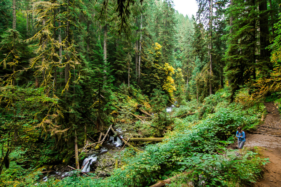
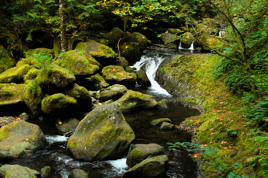
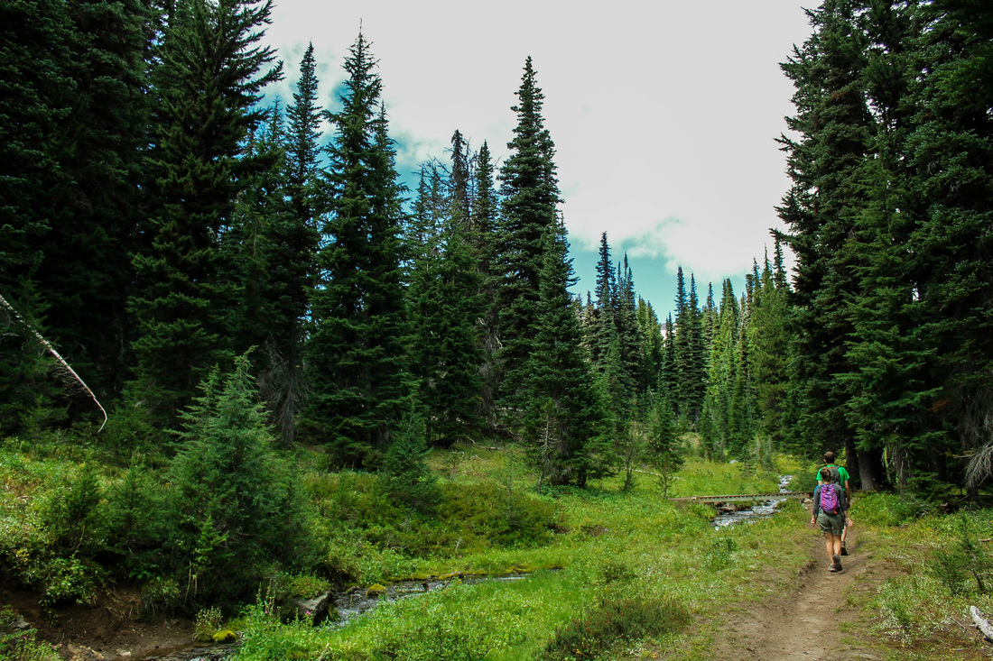
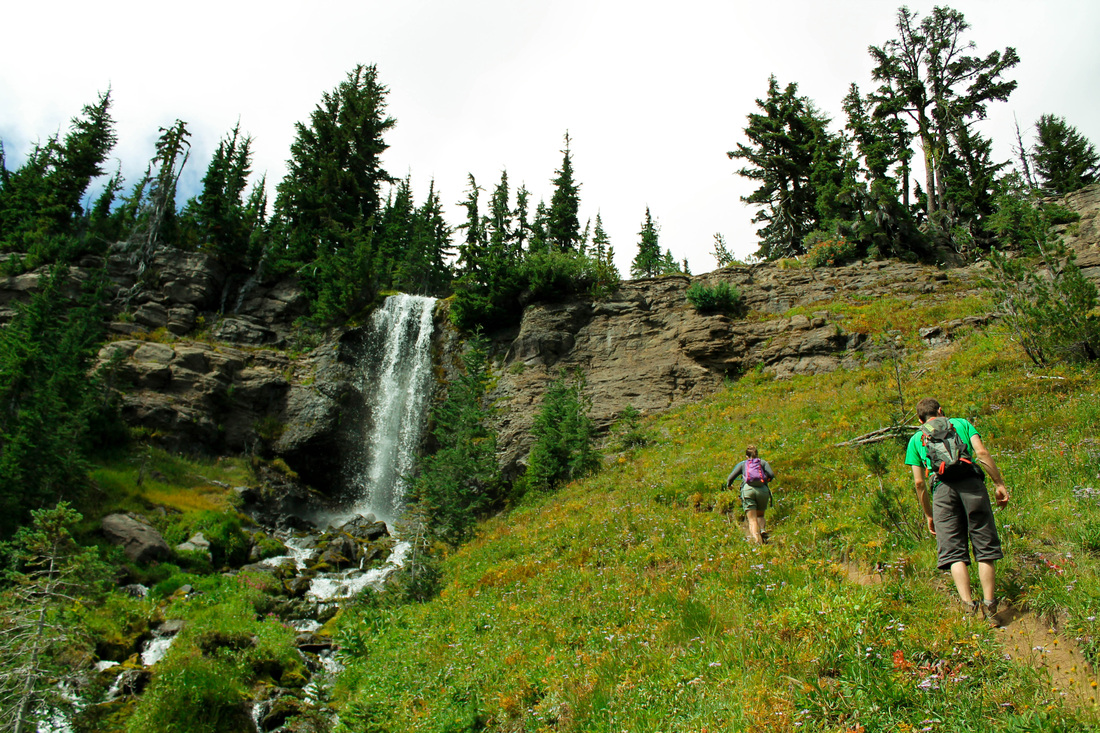
There is a viewpoint that branches off to the left at the first intersection, keep right to stay on the loop hike. Continue the ascent into Wahkeena Canyon, climbing another few hundred feet until you reach the next intersection is with a trail to Angel's Rest. Stay left and continue until you hit the 4 way junction. Go straight to stay on the trail (to the right is Devil's Rest trail). Now you can relax as the elevation is done and all that is left is a walk through the woods and then a stroll past several waterfalls. 
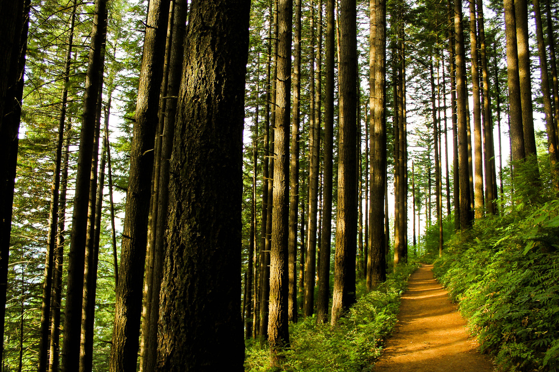
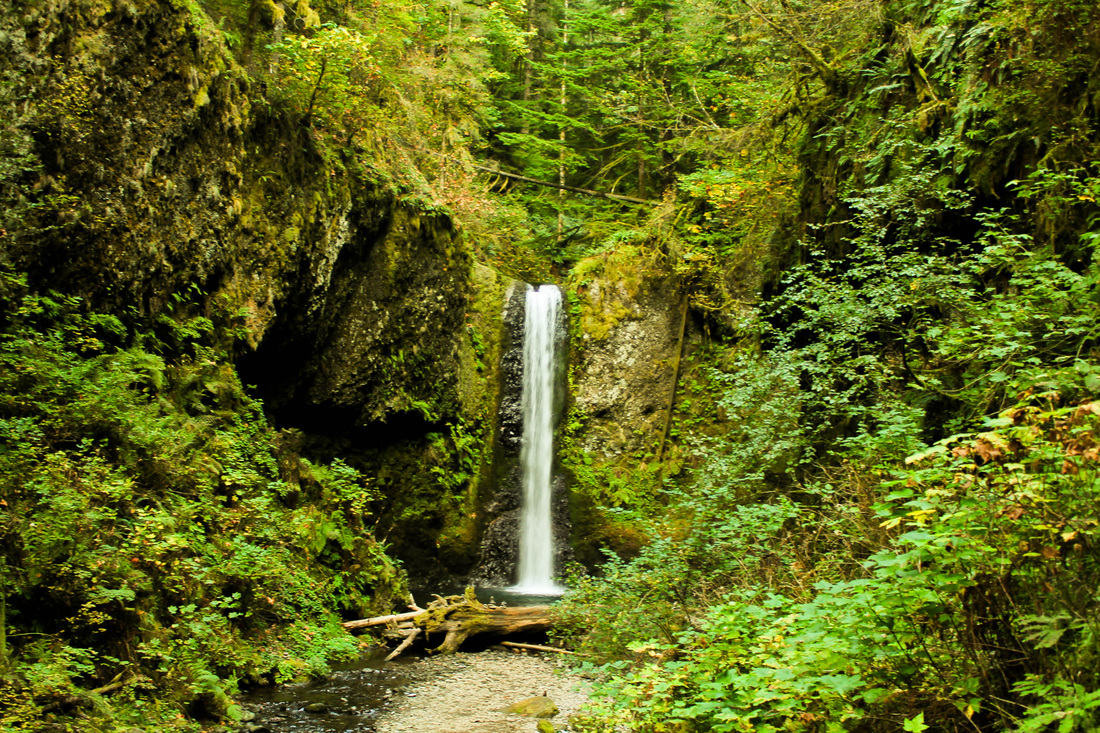
After passing Ecola Falls and Weisendanger Falls, you can take the short option for the viewpoint over Multnomah Falls. From there, it's about 15 minutes to the lodge. It took Mary and me 3 hours to complete the 5 mile loop.
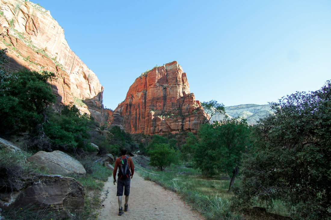
 The Hike:
0 Comments
We made our way to Kolob Canyon after deciding against traveling to Capitol Reef or The Grand Canyon for fear of flash flooding. We drove straight from Bryce Canyon and arrived around noon on Thursday. This portion of Zion is far less crowded than its southern counterpart. We were able to drive to the end of the scenic road and snap a few photos from a scenic overlook. Then, we randomly chose a hike to do. Distance was the only thing guiding our decision, and we decided to hike Taylor Creek Trail. The trail begins by descending down stairs. Then, the trail crisscrosses over Taylor Creek at least 15-20 times, which is nice because it gives you a chance to cool off on a hot day. In the beginning, the trail is mostly exposed. As you hike further into the canyon, trees become more dense and the trail actually becomes entirely shaded (even in mid-day). The majority of the trail gradually ascends as you proceed into the canyon. This hike was a treat as it gave us a break from the herds of people at the other two parks we were at earlier in the week. We only ran into 4 or 5 other groups of hikers that day. We took our time and admired both the towering canyon walls and the beauty in the foreground. Aaron identified some fossils and we both remarked on the interesting salmon-color of the sand around us. Since we had chosen this hike at random (more or less), we really didn't know what to expect at the end of it. Before we knew it, we were approaching a double-arch alcove carved from erosion. We had the place to ourselves. This ended up being my favorite hike of the trip partially because everything on it was a surprise as we did it on a whim, and also because it was nice to escape the crowds. We went back the way we came and then drove to our seedy motel for the night. We woke up early and were on the road by 8:30am for Las Vegas. We checked into El Cortez in Old Town and I laid by the pool at the Golden Nugget while Aaron tested his hand at 3-Card Poker. We rewarded ourselves with a bottomless crab-leg buffet that evening with unlimited drinks and then rolled ourselves over to see Zarkana (a Cirque du Soleil show). It was nice to indulge after camping and living off camp-fire food and granola bars for a week. In the morning, I asked Aaron if we could go to a buffet again. This one had bottomless mimosas, and we, once again, let the Vegas mentality of over-indulgence consume us. We flew home to Portland and arrived at 8:30pm. We were greeted by Mary and Jordan who arrived with a bottle of champagne (yes, more champagne), chocolates and a rose. So concludes this week long adventure. What I learned: push yourself physically or you'll never know what you can accomplish; take chances on the unknown/non-researched hike, it may be the best thing you've done; Aaron and I can just about eat our weight in crab-legs and live to tell the tale. The Hike:
After an excellent 3 days in the southern part of Zion, we made the 1.5 hour journey to Bryce Canyon. Just before you enter the Park, there is a really nice landscape that you can hike in. It's called Red Canyon and it's right off the road. We thought it would be relatively easy so I was in sandals. Don't make that mistake. The trail is covered with loose rock and is very steep in some parts. I had to go down on my butt (aka crab-crawl) several times. We arrived at Bryce and went to a geology ranger talk. Aaron participated in the demonstration. Then, we checked into a hotel and were able to shower for the first time in 4 days. We ordered pizza and rested a bit until the astronomy ranger talk. After a long-winded presentation, the group was able to go outside and view different star clusters via giant telescopes. Bryce Canyon is known for its amazing night skies. The park service claims that Bryce has some of the best night views in the world. We were able to see Andromeda and a cluster of stars 6.2 million light years away. The next morning, we checked out of our hotel and found a nice little campsite in the North Campground. We were able to hike into the amphitheater from our site. We started at Sunrise Point and hiked down for the Queen's Garden. We combined this hike with the Navajo Loop and ended at Sunset Point. After completing this, we walked down Wall Street and then back up again. These hikes are filled with the infamous Hoodoos of the canyon. The trail is easy and enjoyable throughout. As we were finishing up our hike, there were some ominous clouds heading our way. Per my request, we rushed back to the campsite to prepare for the storm. The rain never came, but we enjoyed the lightning storm from afar. We had heard about the potential rainstorms in the area, which is why we decided not to travel to Capitol Reef. We entertained the idea of driving to the Grand Canyon, but that, too, had warnings of potential flash floods. Instead we decided to test our luck at the Kolob Canyon portion of Zion... and later in Las Vegas (at least Aaron did). We went to Inspiration Point to watch the sunset. The next morning, I woke up early and appropriately watched the sunrise at Sunrise Point. We left Bryce Canyon and were on the road by 9am, headed towards the NE portion of Zion. The Hike:
Queen's Garden to Navajo Loop:
I had never been to Utah and this was the perfect time to go! Aaron and I had this trip planned since the beginning of the year. Utah was an easy choice with its National Parks in close proximity to each other as well as it being easily accessible from Portland. We had a quick flight to Las Vegas and then a 2.5 hour car ride to Zion. Before leaving Las Vegas, we stopped at a grocery store and stocked up on food and bottled water. We bought a few bottles of cheap wine and some beer. This is important: Get your beer in Nevada! No one warned us about all of the crazy Utah laws regarding alcohol (I suppose we should have known better). All of the beer in Utah is 3.2% alcohol, even the IPA's. It's insane. Also, if you go out to have a drink it is a law that you must purchase food with it. We arrived at Zion around 3pm on Saturday. We scoped out some free campsites (at the recommendation of a friend who had recently visited) and headed into the park. Zion utilizes an efficient shuttle system which cuts down on traffic (and subsequent pollution) in the park. We hopped on board and got off at the Lodge. From here, we decided to squeeze in a quick hike to the Emerald Pools. I hiked this in sandals without any problem. The trail rises gradually and cuts behind and over a waterfall (now, just a light drizzle). At the time we were there (end of the summer) the Emerald Pools appeared more like brown puddles. But still enjoyable, no less! The new terrain and climate excited us. We enjoyed hiking in soft sand and watching the sun light up the sandstone walls around us to a bright red. The Emerald Pools hike is a quick out-and-back 3 mile round-trip hike. It wasn't too busy at the time we did it, but it can be busy during other parts of the day. Definitely worth the quick trip and it was a really nice warm-up hike for us on what was to come with Zion. We then made our way back to the secret free camping spots. Only to find out, the secret was out. We got there around 8pm and all of the easily accessible spots were taken. So we made the journey up the steep, very rocky road. We only got stuck one time. The Honda Civic we rented proved to be a trusty steed as we made this trip 3 times. Our spot was tucked in off the road and had a fire-pit. We ate noodles made over the Biolite and enjoyed a few beers. We woke up at 7am, had oatmeal and coffee for breakfast, and made our way to Zion Adventure Company in Springdale. There, we rented our gear to hike The Narrows. The Narrows is the world's largest slot-canyon. In late summer, all that is needed are canyoneering boots, neoprene socks and a walking stick. This is a package deal for $22 at ZAC. Part of the renting process requires you to watch an 8 minute video on the dangers of hiking The Narrows. A lot of people were hiking The Narrows in tennis shoes or regular hiking boots, but after our first few steps into the water, Aaron and I were both very pleased and appreciative of the gear we rented. It's a small price to pay to have full comfort during this hike. We didn't want our feet being wet/uncomfortable to limit how far we went that day. Aaron's brother and wife had tried doing this hike in March this year and a full wet-suit was required. I was happy that the water never reached higher than mid-thigh. On that note, I recommend that both men and women alike wear shorts that would get you in trouble in Catholic school. Most of the hike is in sand, but you do have to traverse rocks occasionally. We were there during mid-day and we still remained heavily shaded by the tall walls on our sides. There are plenty of places to sit on the sides of the river to take breaks and have a snack. It's quite busy in the beginning, but after only 30 minutes, we were past the crowds and all of the kids. I realized on this hike that one thing I love sharing with Aaron is our hatred for rotten little children. We hiked all the way through Wall Street. There wasn't a moment when we weren't completely taken with our surroundings. I've never done anything like this before and I would go back in a heart-beat. The hike took us about 4 hours. We returned our gear rentals to ZAC and headed back to our campsite around 6:30pm so that we would have some daylight while cooking dinner. That night, we ate potatoes, garlic, mushrooms and onions and had a small fire. I didn't sleep well that night because I was terrified of the hike we were to do the next day: Angel's Landing. Aaron was nervous for his own reasons.... The day started out lovely. We took down our camp and set-up at a different spot that would ensure a great view at sunset that night. We ate fruit for breakfast and stopped for espresso in town. We hit the trailhead by 9:30 am, and I would suggest that you don't do it any later than this. For the start of the hike, the sun hadn't risen over the towering walls of the canyon yet, so we were shaded for the majority of the ascent. The trail is paved until you reach Scout's Lookout (the turnaround point for people unwilling to do the death-defying scramble up the spine of the mountain). After the initial ascent, the trail enters a canyon and then you come upon Walter's Wiggles ( a series of mini-switchbacks) that lead you to Scout's Lookout. After this, the trail is for the able-bodied people. The last 0.5 miles to the top of Angel's Landing is a climb along the spine of the rock formation. It is heavily guarded with chains but is still a tough task for those with a fear of heights. There are several spots where you are on a sheer cliff that drops to the valley floor beneath you (roughly 1700 feet). Keep focused on the goal and your eyes on your feet. I have a pretty strong fear of heights, and I did just fine with this portion of the trail. The above view makes the last bit seem a lot more terrifying than it actually is. However, it is still dangerous and there have been a number of deaths on this hike in the past few years (trust me, I looked into it thoroughly). In my opinion, the first part that is chained is actually the most difficult and scary. After this, any anxiety I had disappeared and I was actually able to enjoy the part I had been stressing over for days. It was quite empowering. We reached the summit and took in the magnificent view. It reminded me of Yosemite Valley except with red sandstone walls instead of granite. It's one of the most beautiful places I've been. On top of Angel's Landing, Aaron proposed to me, making this location even more special and unforgettable. We floated back down to the valley floor and decided to take a dip in the Virgin River to cool off. We shared a beer and I stared at the ring on my finger for about 20 minutes (my precious). We rewarded ourselves with draft beers and a burger at the Zion Canyon Brewing Company. Then, we took the shuttle back into the park to the Court of the Patriarchs stop. We went to the Human History Museum to view a movie about the park as well as to see the Altar of Sacrifice: a rock formation where Mormons sacrifice virgins... or something like that (see picture below). We retreated to our campsite and watched the sunset onto the red stone. We ate a fine meal of potatoes and shared a $3.99 bottle of wine. It was a good day. The Hikes:
Emerald Pools:
The Narrows:
Angel's Landing:
This hike was on my list of things to do since we did the Trout Lake Ice Caves earlier this year. I learned of this hike from the Curious Gorge book. However, I don't really consider the location of this hike in the gorge. The book lists the trailhead as 2 hours from Portland, but it's really more like 2.5 hours. The last 10 miles is on a gravel road that is in poor shape so it takes about 35 minutes to do this part alone. It's in the Yakama Nation territory so no other pass will suffice except for paying the $5 day fee. Go past Mirror Lake and park at Bird Lake. This is a 5.5 mile loop hike and I recommend doing it clockwise. It's less steep this way and keeps the views of Mt Adams a surprise for the end. The path starts by winding back and forth over a creek with an assortment of flowers. We caught the tail end of the display of wildflowers. Curious Gorge recommends going in mid-August. About a mile in you come to Crooked Creek Falls. Continue on the trail until you come to a junction. Take a right and continue on the Around the Mountain Trail. This will meander through a few meadows and cross a few creeks with little to no effort on your part. Views of Mt Hood and eastern Washington will improve as you continue. At the next junction, take a left onto the Trail of the Flowers. Although the sign indicates there are signs to educate you on the flowers and geological features, all we found were signs telling us to stay on the path to prevent erosion. After you turn left onto the Trail of the Flowers, all you have left until Hellroaring Canyon Viewpoint is about a mile and 400 feet of elevation gain. This is the most difficult part of the hike and it is really quite easy. During our hike, clouds obscured the sight of Mt Adams, but by the time we reached our destination, the clouds parted and we were able to see perfectly. Continue clockwise to complete the loop. The trail descends quickly for about a mile. When you come to a junction, turn R and then turn L onto Bluff Lake/Bird Lake Trail. You'll arrive at Bluff Lake quickly. After passing Bluff Lake continue the half mile back to Bird Lake where you parked. There is also camping available at this lake in addition to Mirror Lake (the one you pass while driving to Bird Lake). For our drive, we made a loop out of this as well. We got there on the Washington side of the Gorge and then returned by crossing the bridge to Hood River. This makes for a nice spot for lunch or dinner. We like to stop at Double Mountain for pizza. Take 84 all the way home!
The Hike:
After dealing with the stress of finding a new place to live and coming up short all week, a vacation to Central Oregon was more than welcomed. We hit the road around 4pm on Friday and the drive was smooth sailing once out of Portland traffic (Which is made up of 2/3's bad drivers. Mary has lived here 2 weeks and she can confirm this). We took 26 over Mt Hood and through Madras. This was all new territory for Mary and she was able to enjoy the views of Mt Jefferson and the Three Sisters as the sun was setting. We headed straight to Paulina Lake Campground and reached our destination around 9pm. After setting up camp, Aaron tracked down the camp hosts for firewood. The hosts were a sweet, older couple with a giant RV with the vanity plate "Jesus". We had all underestimated how cold it would be at night in the campground. Paulina Lake and East Lake lie in a collapsed caldera that is 5 miles wide. This is similar to Crater Lake. The campground is at about 6,000 feet elevation. So even in the middle of August, it gets cold at night. Just ask Mary. Mary and I woke up at 5am so that we could drive to the top of Paulina Peak to watch the sunrise. Fortunately, there is a road straight to the top. For the more ambitious, there is a hiking trail which sounds quite strenuous. We waited as the sky went from darkness/stars to a purple and finally the sun appeared. And yes, it was shining like a red, rubber ball. Paulina Peak is the highest point in the area (7900 feet). This spot is ideal for great views. In fact, on a clear day, you can see all the way to Mt Shasta in California and Mt Adams in Washington! We went back to sleep until 10am and then enjoyed breakfast and coffee. We took the quick drive down to the Big Obsidian Flow. This is an easy (1 mile long) interpretive trail that is great for the family. Even though it is easy, wear a sturdy/protective shoe. Obsidian is glass, so the trail is literally made out of crushed glass. We came across several bleeding humans on the trail. The Big Obsidian Flow is the youngest lava flow in Oregon. We ran into a group of Wisconsites on the trail! After the mini-hike, we stopped in at the Visitor Center and then did the short walk to Paulina Falls from there. We all concurred that this hike is a 1 for difficulty and 7 for payoff. You follow along a creek the entire way, never really losing or gaining elevation, on a well beaten path that suits even the creakiest of knees. This "hike" is 1 mile round trip. After the falls, we took a drive into Bend to have a beer and get a bite to eat. We got back to our site around 8pm and had a fire. We decided that we would likely not go to the hotsprings in the morning. And, instead, do a hike in the McKenzie Pass. The reviews I read on the Paulina Lake hotsprings were all good. However, a park ranger insinuated that they may have algae and that they are very shallow pools. We decided that we didn't want to risk the 3.5 mile hike one-way to the springs as it would then be a full-day commitment. We packed up camp and hit the road again. First, we drove up to Paulina Peak to get a day-view of the surrounding area. Then, we headed home. To get to the McKenzie Pass Hwy, you go through Sisters and then take a left when indicated. This scenic by-way adds time onto your drive, but it is well worth it. The road is only open a few months out of the year so it's important to take advantage of this option when able. I've been told that early in the summer, the road has only one lane plowed and is open exclusively for cyclists. If I was any sort of a biker, I would do this for sure. About 10-15 miles into the drive, you'll happen across Dee Wright Observatory. This is a really neat building made out of lava rock that has little labeled peep holes to view the surrounding mountains. There is also an easy interpretive trail here that is paved. Just past the observatory is a trialhead on the right-hand side of the road. This trail is a portion of the Pacific Crest Trail. We hiked out on it for about and hour and then turned back because of the time of day, considering we had about 4 hours left of driving to get back to Portland. We passed a lot of backpackers here. I intend to come back to complete this trail to Belknap Crater. This trail is predominantly hiking over lava rock. Wear good shoes to avoid any injury. We ate dinner in the car and headed back to Portland, arriving at 9pm.
With the recent arrival of our dear friend Mary, we decided to explore some new territory. We went to the NE side of the mountain upon the suggestion from a past patient of mine. We left Portland at 6am on Saturday and headed straight to White River Campground on a mission to get one of the walk-up sites. I had checked for reserved sites a few weeks prior and they were all taken. Because a lot of places are at higher elevations (hence snow) the peak times to visit are limited and spots get snatched up well in advanced. If you don't mind the gamble, you can take your chance at getting a walk-up. We arrived at the campground at 10am and we were lucky to find several spots available. We set up camp and headed to the Summerland Trailhead. The trailhead is about 4 miles from the campground and it was packed. We had to park over a half a mile down and walk up. Despite the amount of cars there, the trail itself didn't feel overly crowded. As we were walking to the trail, Aaron got bloody nose and stepped on a dead squirrel. This, in conjunction with the toothpick-sized splinter stuck under his nail he attained from earlier that morning, resulted in a rough start for Aaron. But he persevered and is now a stronger man having survived these trials and tribulations. The hike begins with a stroll through an old growth forest. As always in the Pacific Northwest, the forest is magical and inviting. It's layered with old trees that have fallen and with new ones just starting to grow. You can hear the White River flowing alongside the trail the entire time you're in the trees. You get glimpses of the river during your minimally graded ascent. Three fourths of the hike is in the forest and is really enjoyable. Once you emerge from the trees, you come across a bridge that crosses the river. This is a great place to have lunch. You have a view of Mount Rainier and there are plenty of rocks to sit. The only complaint I have about this spot is that there are a lot of flies. Since we are spoiled in the northwest with an absence of bugs, namely, mosquitoes, it's even more annoying when you do encounter the tiny pests. After crossing the river, you'll find yourself in a lovely little meadow of purple flowers with the distant mountain in the background. After hiking through this for less than ten minutes, you'll reach the most difficult part of the hike: switchback leading up to Summerland Meadow. That being said, we got through the ascent in less than 20 minutes. At the top, there is a backpackers campground with a bathroom available. We rested a bit and took in the sights. We decided to continue on the trial a bit further. At which point we realized that this was the real climax of the hike. It was magnificent. Continue the trail up the stairs, through the meadow of purple flowers, along the babbling brook to a welcomed change of scenery. The ground transitions into rock and you'll continue to climb until passing over another river. A majority of the rocks are a green color that I haven't encountered before. Aaron informed me that these types of mineral are rare and formed deep within the volcano. We also saw a waterfall which is the highest point I have ever seen one. You stroll past glaciers and finally come to a small lake which is turquoise in color and perfect for chilling the beer you brought with. Which is good because Rainier Beer is intolerable if it isn't served cold. After throwing back a few Rainiers, return the way you came. That night we were treated to an amazing moon over the White River. I still haven't mastered taking night photos so it doesn't quite capture what we experienced. But it looks amazing no less. The next day, we headed up to Sunrise Visitor Center. It's the highest elevation point you can drive to in the park. We took in the view and shopped for souvenirs. Then, we drove back down and around the south side of the park to Paradise. This place was insanely busy. We had to park a bit past the lodge/visitor center and walk back up the road. There are several trails that leave from this point that are easy considered easy in the spectrum of hiking, thus making it so popular (especially for families/kids). We hiked up Deadhorse Creek Trail with about a hundred other people. It's paved most of the way and winds through fields of wildflowers with Mount Rainier towering over the landscape in the background. Despite signs everywhere asking people to remain on the trail to protect the fragile meadow, people are gallivanting about wherever they please. It's frustrating to watch. We hiked up to Glacier Vista and then turned back around. Glad we did it but I won't hike from Paradise again. It's just too busy and I don't like going in nature to be around herds of people and small children. DO: Explore the NE portion of the park near the White River. We barely skimmed the surface but this area was fantastic and less crowded. DON'T: Go just to Paradise and expect to have any sort of a peaceful experience with nature. It is a zoo of people and it's distracting to the beauty. If you're with someone who isn't in good shape, this would be a better option since the trail isn't hard and paved most of the way. DO: Carry a few cans of Rainier with you on your hike. It's fun! DON'T: Expect the beer to taste that good, even when it's cold and you're hot. The Hikes:
Summerland to Panhandle: Elevation: 2,950' Distance: 12 miles RT Deadhorse Creek Trail: Elevation: 400' Distance: 2.4 miles RT National Parks Pass or America the Beautiful Pass With the Portland temps hovering around the 90's all week, I was looking for a place to cool off this weekend. I knew of Dougan Falls on the Washougal River from when Sarah took Shannon Glynn and me here in August 2011. It proved to be just as refreshing, and busy, as the last trip I made here. Aaron and I went to our friends Jon and Marissa's wedding the day before, so we were looking for a relaxing day without the effort of hiking into a waterfall. This was the perfect spot. There is no hiking required to get to the falls, which is why it is busy. We arrived to the spot around 12:15 pm only to realize we needed a WA Discovery Pass for parking here. We had to back track into a town to purchase one. We bit the bullet and bought a full year pass. It's the 3rd time we have driven quite a ways where one was required and there are never any signs until you are at the destination, which at that point, you're far from anywhere that sells them. So we arrived for the second time, with pass in hand, around 1:00 pm. Surprisingly, at this time, there were only about 25 other people there. By the time we left at 3:30 pm, it was the sight you see above. There are places to the side where you can jump into the pools from rocks. Above the falls, there are small pools that you can swim through. We picked a quieter spot above the falls (by 3:30 we had been surrounded). The drive takes a little over an hour from Portland. It's only a few turns so it is rather easy to find. I suggest wearing some sort of water shoe for exploring around the river's pools and falls. There are a lot of slippery rocks, but it still makes for a popular place for families with small kids.
So the tips: get there before noon and you'll essentially have the place to yourself. The people coming to party won't drag their asses out of bed in time to get there before 3:00 pm. Have a Discovery Pass so you don't have to back track like we did. The pass is $35 and is good for one year from the date of purchase. Clean up after yourself and others so this place doesn't become a garbage dump. People had snorkel gear, we didn't know to bring ours. Bring a floaty for the water. Bring a folding chair to sit on since there are no sandy spots, it is all rocks. It's a great spot on a hot day! The first time we hiked Mt St Helens (MSH) was for Aaron's birthday last year (July 8th). We hiked it with Aaron's brother, Seth, and his lovely wife, Jennie. This year, we hiked with friends Maria, Jake and Nate. We arrived at the climbers bivouac (I love that word) around 7pm on Friday night after battling traffic. We got our fire going to so that we could cook dinner. It was a clear night and the stars proved to be shinning bright. Maria, Jake and I hit the hay relatively early. Aaron and Nate stayed up drinking beers, and I fell asleep listening to their alcohol influenced conversation about galaxies far away and "weird dark matter that is surrounding the universe and making it expand infinitely." We all got up around 5am on Saturday and quickly got to work cleaning up camp. Maria made us an amazing hot breakfast of potatoes and eggs with the works. We hit the trail at 7:11 and started our trek through the woods. From the trailhead, it's 2.25 miles to the start of the Monitor Ridge trail. Permits are required to hike above 4,800 feet. This is important: if you plan to hike MSH, you need to get your permit ($22) the day they go on sale. If you want to hike on a weekend in the summer, you need to get your permit within the first 10 minutes. They are limited to 100 hikers/day and they sell out fast. Last year, we were on the trailhead at 6am. I would recommend leaving at this time. It makes for better views at sunrise. And, if you're a slower hiker like me, you will have plenty of time to reach the summit and get back down in time to grab pizza at the Lone-Fir in Cougar. The first portion of the hike is a 2 mile (900 feet) stroll through woods. Upon leaving the forest, you'll immediately happen upon piles of boulders, and remember that you're hiking the most active volcano in the Cascade mountain range. You'll traverse a few switchbacks and then hit the Monitor Ridge Trail. After this, any vegetation will be sparse. Pumice and sharp boulders, however, will be plentiful. After hiking up an ash ridden ridge, you'll come across the boulder fields. At this point, ditch your poles, put on gloves with a grip and start climbing. Personally, I prefer this over walking up ash that slides under your feet. Views improve of both Mt Adams and Mt Hood during the entire ascent. You're quickly above the clouds so even if the mountains are unseen from Portland, you'll be lucky enough to keep the views. During the hike, you'll go through several wardrobe changes. Both times, I wore every layer and article of clothing that I brought with. Weather changes quick on mountains. When we hiked it in 2013, it was much sunnier, however, colder. This year, we felt the wrath of the wind gods. I think it took us longer to hike because the wind would come on so strong, we had to hunker down and brace ourselves until it passed. We were also slightly delayed as Nate was enamored with the inside of a glacier. After completing the boulder field, you lie your eyes on the only thing between you and the summit: a steeply graded 1,000 foot gain of sand-like ash. It's a good idea to find a boulder in the distance as a goal to take your next break. Before you know it, you'll be at the top! Take in the views at top and fuel up for the descent. A fun option is to glissade down the glacier. It is awesome. The best way is to bring up a large trash-bag to don as a diaper (just kick threw two holes out the bottom). You may have some bruises on your bottom (an actual bone bruise if you're Seth), but when are you going to get another chance to sled down a volcano? After your hike, head to the Lone-Fir in Cougar to sign out that you made it off the mountain. Since Portland is a bit of a drive back, it's wise to eat pizza here as you will be famished. It's not the best but it doesn't have to be when you're that hungry. The Hike:
We left after work on Thursday for the holiday weekend. We headed straight to our campsite at the Kalaloch Campground on the Washington coast. It was a 4 hour drive, and we arrived to our campsite around 11:00pm. The closest town is Aberdeen; Kurt Cobain's hometown. We were able to find enough wood around the site to build a small fire that would last a few hours. The campground was full, but we were lucky that our site was pretty secluded and had a path with direct access to the ocean. I was really excited to get some night shots with my newly purchased tripod. When we got to the ocean, the above picture was the view. The half-moon was bright orange and hovering just above the horizon. I got the camera set up in time to take 2 pictures before the moon disappeared behind clouds. The stars there were the best I had seen in years, and we had the whole beach to ourselves. I will definitely return to this spot. We took a short walk in the morning, packed up our things, and continued on. The drive from Kalaloch to Sol Duc Resort is somewhat anti-climactic. Although, Aaron and I were in a parade for the 2nd time this year. The first time, we drove through downtown Portland with Mary and Kara just before the Rose Festival Parade. There were hundreds of people lined up, a lot of them waving to us. This time, we found ourselves in the middle of the Forks 4th of July celebration. It was quite a different scene. Everyone was sitting in the beds of their pick-up trucks eating fried gas-station food. I tried waving but only received confused stares in return. The bottom line: I wouldn't go out of my way to Forks just because of the Twilight series. It's not cool. We reached the ranger station nearest to our entering point. The ranger, Carl, was very helpful and assisted with changing our permits so that we could camp at Deer Lake in lieu of the fact that our planned hike to Hoh Lake was still under snow. We decided against the possibility of falling and injuring ourselves and chose to camp at Deer Lake. We parked at the Sol Duc Hot Springs Resort and began our hike. We started at the Mink Lake trailhead (also one end of the Lovers Lane Trail). We could have driven to the end of the road (the Sol Duc Falls trailhead) and cut the hike by 2 miles, but we were ambitious and Aaron really wanted to hike Lovers Lane with me :) After 3 miles, we reached Sol Duc Falls. After a short stop at the falls, we continued toward Deer Lake. This is where the elevation started. We had another 3.5 miles to hike and 1,600 feet to gain. The trail is rocky and is a steady incline. This proved to be difficult for me as it was my first time hiking with a large pack. There was a fine mist falling; just enough to make the trail slightly more difficult. We took plenty of breaks. There are 2 camping spots along the way, which is an easier option. The sites looked nice, and were nestled along Canyon Creek. We reached Deer Lake at 5:30pm, a total of 5.5 hours of hiking (with all of the breaks and stopping by the waterfalls). We chose a really cute campsite that was very isolated. I suppose all of the sites are isolated up there. We had to cross a narrow board over a marshy area to get to the spot. It had some overhead coverage, which was quite helpful as it was still drizzling rain. We set up camp and then started dinner. It was my first time eating dehydrated food, and - at the time - the pad thai was the greatest meal of my life. I was cold and quite hungry. Having a hot meal made all the difference. Also, the Biolite saved my sanity that night. It was 6:30 when we were done eating and we had about 4 hours left of sunlight. We weren't permitted to have a campfire above 3,500 feet, so we busied ourselves by feeding the Biolite and seeing how big of a fire we could make. We did this for 2 hours until hitting the tent. We both fell asleep before 9:00pm. I dreamed about bears that night. They were the only bears I saw all weekend. In the morning, we decided to pack up and head out a day early. Any day hike we could do, was still covered in snow. Lesson learned: don't go to Olympic National Park until later in the summer. Also, bring a deck of cards or some dice or paper and a pen.... something, anything to pass the time! The hike we really wanted to do was the High Divide. It was unreachable at this time of the year. We made a loop hike on the way out, passing Mink Lake. This hike was preferred by both of us to the hike on the first day. We had some panoramic views of the countryside, and we saw a small family of deer about 7 or 8 miles into the back-country. We only saw 2 other hikers on this trail. We didn't start seeing people again until we hit Mink Lake. The total distance of the loop was about 14 miles. We drove northeast to the Crescent Lake Lodge and had a beer. There are a dozen or so cabins on the lake which is an option for the less outdoorsy person. We had dinner and spent the night in Port Angeles. The next day, we drove up to Hurricane Ridge. As the first time I went, it is very busy with people and deer. There are a few short, paved trails as well as a 3 mile round trip trail called Hurricane Hill. Because we were tired, and it was slightly cloudy so the mountains were partially covered, we didn't hike that day. We also drove up a four-mile-long forest road to reach the Mt. Walker viewpoint. It was worth the slow-going drive even on a cloudy day, as the Seattle metro area was in view in the far distance. On a clear day you can see Mt. Rainier, the Space Needle, Puget Sound, and Mount Baker. We made a few side trips on the drive home; including a stop at our favorite sushi spot in Kelso. The Hike: Mink Lake trailhead --> Lovers Lane -->Deer Lake --> Mink Lake --> Mink Lake trailhead
|
I moved to the Pacific Northwest in August of 2012. I quickly identified myself as a hiker. I want to document my experiences so that I can refer to them for myself and others to provide the best hiking experience. I also hope to learn more about hiking from others comments and recommendations. Archives
April 2016
Categories
All
|